Cof Cymru: National Historic Assets of Wales · Wales
Lansdowne School, School House
Canton, Cardiff, Wales
A Grade II listed building in Canton, Cardiff, designated on 8 November 2001.
The record
- Designation
- Listed building, Grade II
- Broad class
- Domestic
- Date of designation
- 8 November 2001
- Locality
- Canton
- Town
- Cardiff
- Community
- Canton
- Unitary authority
- Cardiff
- Country
- Wales
- Coordinates
- 51.48134, -3.21409
- Cadw reference
- 25855
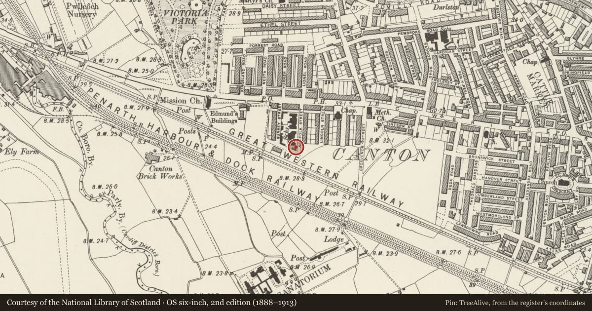
Slide toward Today to fade the historical sheet and see the modern map underneath.
David Rumsey Map Collection, Stanford LibrariesDavid Rumsey Map Collection, Stanford LibrariesDavid Rumsey Map Collection, Stanford LibrariesDavid Rumsey Map Collection, Stanford LibrariesDavid Rumsey Map Collection, Stanford Libraries
5 historical maps cover this location, the earliest the 1636 map "Cornubia : Devonia, Somersetus, Dorcestria, Wiltonia, Glocestria ..." (David Rumsey Map Collection, Stanford Libraries).
Historical maps covering this location
- 1636 · Cornubia : Devonia, Somersetus, Dorcestria, Wiltonia, Glocestria ... (David Rumsey Map Collection, Stanford Libraries)
- 1637 · The fourth table of England. Cornub. Devonia, Somerset etc. (David Rumsey Map Collection, Stanford Libraries)
- 1865 · England and Wales. England No. 6. (David Rumsey Map Collection, Stanford Libraries)
- 1898 · 263 Cardiff (Hills) (David Rumsey Map Collection, Stanford Libraries)
- 1913 · Sheet 110. Cardiff & Mouth of the Severn. (David Rumsey Map Collection, Stanford Libraries)
Cadw's description
Location
In the centre of Canton Community about 700m west of Canton Cross.
History
Built in 1896-8 and designed by Veall and Sant. One of a series of schools built by the Cardiff School Board and designed by these architects. This one is almost unaltered externally. The school became a military hospital during WWI.
Exterior
Newbridge sandstone rubble walls in courses with Bath stone dressings and Welsh slate roof. Two storey cottage with gable end to Norfolk Street and long side to Lansdowne Road. The gable end has a canted bay below and a 3-light stone mullioned window above, modern plastic windows. Slit vent in the gable above. Steeply pitched roof with the chimneys missing. Small windows in the long side elevations. The Lansdowne Road elevation has two windows and a door with sidelights on the ground floor and a paired window above. The left hand end has a slightly lower roof line, coped gables.
Interior
Interior not seen at resurvey.
Reason for designation
Included as part of a well designed and almost unaltered late C19 Board School. The school house is the most altered part but it is included for its group value with the other school buildings.
Nearby in the register
- Lansdowne School, InfantsEducationunder 1 mi
- Lansdowne Road School, JuniorsEducationunder 1 mi
- Former Drinking Fountain canopy in rose garden of Victoria ParkGardens, Parks and Urban Spacesunder 1 mi
- Milepost outside No.240Transportunder 1 mi
Other entries of the same register within about three miles of this one, by straight line.