Cof Cymru: National Historic Assets of Wales · Wales
Pant Llwyni
Llanycil, Gwynedd, Wales
A Grade II listed building in Pant Llwyni, Bala, Llanycil, Gwynedd, designated on 22 October 2001.
The record
- Designation
- Listed building, Grade II
- Broad class
- Domestic
- Date of designation
- 22 October 2001
- Locality
- Pant Llwyni
- Town
- Bala
- Community
- Llanycil
- Unitary authority
- Gwynedd
- Country
- Wales
- Coordinates
- 52.94637, -3.73226
- Cadw reference
- 25823
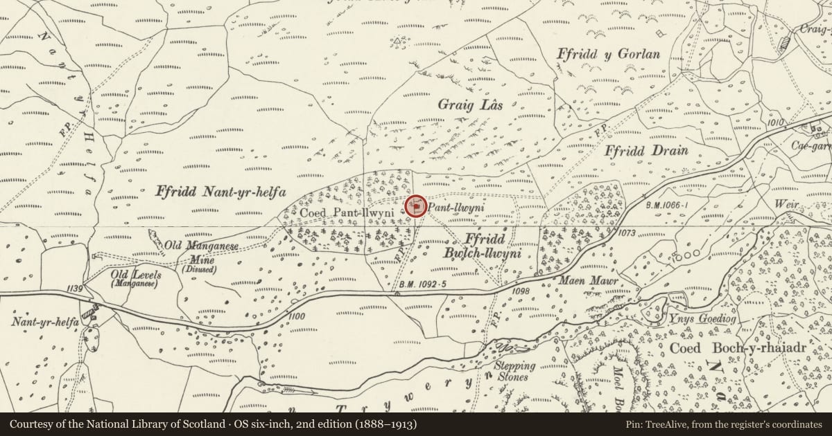
Slide toward Today to fade the historical sheet and see the modern map underneath.
David Rumsey Map Collection, Stanford LibrariesDavid Rumsey Map Collection, Stanford LibrariesLlyfrgell Genedlaethol Cymru – The National Library of WalesDavid Rumsey Map Collection, Stanford LibrariesDavid Rumsey Map Collection, Stanford Libraries
5 historical maps cover this location, the earliest the 1795 map "To Sir Watkin Williams-Wynn Bart ... the map of the six counties of North Wales is most humbly inscribed by his obedient humble servant" (Llyfrgell Genedlaethol Cymru – The National Library of Wales).
Historical maps covering this location
- 1795 · To Sir Watkin Williams-Wynn Bart ... the map of the six counties of North Wales is most… (Llyfrgell Genedlaethol Cymru – The National Library of Wales)
- 1830 · V.3:11-15:XV. Britisches Reich. A. Kon: England. b. Frstenthum Wales: Shire: 37-40 (David Rumsey Map Collection, Stanford Libraries)
- 1883 · Watershed map England, Wales 3. (David Rumsey Map Collection, Stanford Libraries)
- 1898 · 120 Corwen (Hills) (David Rumsey Map Collection, Stanford Libraries)
- 1901 · Sheet 9 and 10. (David Rumsey Map Collection, Stanford Libraries)
Cadw's description
Location
On rough ground on the slopes of Arenig Fawr, north of the A4212 above Afon Tryweryn, immediately west of the western end of Llyn Celyn.
History
From its siting in stone walled enclosures taken out of the rough grazing land of Arenig Fach, the cottage seems likely to have originated as an encroachment. Such encroachment holdings were once common in the uplands of the area, a phenomenon of the early C19 especially. This small dwelling is probably mid C19 (though as such may represent the reconstruction of a somewhat earlier dwelling).
Exterior
Small single storeyed cottage. Whitewashed stone, and slate roof with gable end stacks. Tall single storey, with central doorway in small lean-to porch ( a modern addition), flanked by 2-pane sash windows. Loft light in gable end. Small lean-to against right hand gable return.
Interior
Not inspected at time of resurvey.
Reason for designation
Listed as a small C19 cottage, retaining the character of an encroachment small holding, in a fine upland context.
Nearby in the register
- Pair of former Quarry Workers' CottagesIndustrialunder 1 mi
- Capel Celyn Memorial ChapelCommemorative1 mi
- Pont Rhyd-y-FenTransport1 mi
- Pont Tai-Hirion Old BridgeBridge2 mi
Other entries of the same register within about three miles of this one, by straight line.