Cof Cymru: National Historic Assets of Wales · Wales
Barn opposite St Beuno's Parish Church
Llanycil, Gwynedd, Wales
A Grade II listed building in Llanycil, Gwynedd, designated on 22 October 2001.
The record
- Designation
- Listed building, Grade II
- Broad class
- Agriculture and Subsistence
- Date of designation
- 22 October 2001
- Locality
- Llanycil
- Community
- Llanycil
- Unitary authority
- Gwynedd
- Country
- Wales
- Coordinates
- 52.90115, -3.61518
- Cadw reference
- 25806
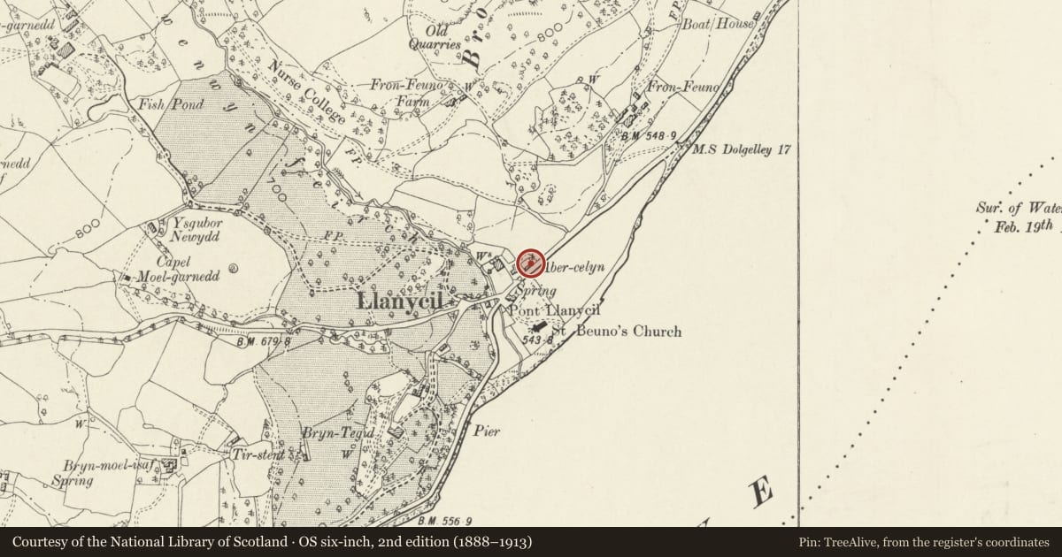
Slide toward Today to fade the historical sheet and see the modern map underneath.
David Rumsey Map Collection, Stanford LibrariesDavid Rumsey Map Collection, Stanford LibrariesLlyfrgell Genedlaethol Cymru – The National Library of WalesDavid Rumsey Map Collection, Stanford LibrariesDavid Rumsey Map Collection, Stanford Libraries
5 historical maps cover this location, the earliest the 1795 map "To Sir Watkin Williams-Wynn Bart ... the map of the six counties of North Wales is most humbly inscribed by his obedient humble servant" (Llyfrgell Genedlaethol Cymru – The National Library of Wales).
Historical maps covering this location
- 1795 · To Sir Watkin Williams-Wynn Bart ... the map of the six counties of North Wales is most… (Llyfrgell Genedlaethol Cymru – The National Library of Wales)
- 1830 · V.3:11-15:XV. Britisches Reich. A. Kon: England. b. Frstenthum Wales: Shire: 37-40 (David Rumsey Map Collection, Stanford Libraries)
- 1883 · Watershed map England, Wales 3. (David Rumsey Map Collection, Stanford Libraries)
- 1899 · 136 Bala (Hills) (David Rumsey Map Collection, Stanford Libraries)
- 1901 · Sheet 9 and 10. (David Rumsey Map Collection, Stanford Libraries)
Cadw's description
Location
Prominently-sited on the roadside.
History
Late C18 or early C19 barn. The barn belonged to the former rectory and is traditionally known as the Tithe Barn.
Exterior
Long rectangular barn of 5 bays; rubble construction with slate roof. Irregular openings to the main (road-side) elevation: the L section has 2 rectangular loft openings under the eaves with long vent slit diagonally below to the L; the right-hand section has a further, centrally-placed rectangular loft opening with slatestone lintel and paired flanking vent slits. Further upper loft entrance to the R gable.
Interior
The interior was not inspected at the time of survey.
Reason for designation
Listed as a late C18 or early C19 barn retaining good original character in a prominent roadside location.
Nearby in the register
- AbercelynDomesticunder 1 mi
- Llanycil CottageEducationunder 1 mi
- Parish Church of St Beuno including two C17 Chest Tombs adjoining at the SW CornerReligious, Ritual and Funeraryunder 1 mi
- Bryn TegidDomesticunder 1 mi
Other entries of the same register within about three miles of this one, by straight line.