Cof Cymru: National Historic Assets of Wales · Wales
9-12 (consec) St Ann Street including forecourt railings
Chepstow, Monmouthshire, Wales
A Grade II listed building in Chepstow, Monmouthshire, designated on 24 March 1975.
The record
- Designation
- Listed building, Grade II
- Broad class
- Domestic
- Date of designation
- 24 March 1975
- Locality
- Chepstow
- Town
- Chepstow
- Community
- Chepstow
- Unitary authority
- Monmouthshire
- Country
- Wales
- Coordinates
- 51.64488, -2.67125
- Cadw reference
- 2577
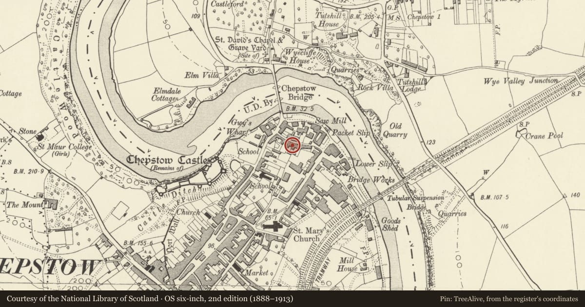
Slide toward Today to fade the historical sheet and see the modern map underneath.
David Rumsey Map Collection, Stanford LibrariesDavid Rumsey Map Collection, Stanford LibrariesDavid Rumsey Map Collection, Stanford LibrariesDavid Rumsey Map Collection, Stanford LibrariesDavid Rumsey Map Collection, Stanford Libraries
5 historical maps cover this location, the earliest the 1636 map "Cornubia : Devonia, Somersetus, Dorcestria, Wiltonia, Glocestria ..." (David Rumsey Map Collection, Stanford Libraries).
Historical maps covering this location
- 1636 · Cornubia : Devonia, Somersetus, Dorcestria, Wiltonia, Glocestria ... (David Rumsey Map Collection, Stanford Libraries)
- 1830 · V.3:11-15:XV.Britisches Reich. A. Kon: England. a. England ab sich: Shire:15-17, 33 (David Rumsey Map Collection, Stanford Libraries)
- 1895 · Sheet 11. Ordnance Survey of England and Wales. (David Rumsey Map Collection, Stanford Libraries)
- 1897 · 250 Chepstow (Outline) (David Rumsey Map Collection, Stanford Libraries)
- 1905 · 250 Chepstow (Hills) (David Rumsey Map Collection, Stanford Libraries)
Cadw's description
Location
Towards the centre of the range in the narrow part of the street.
History
Late C18.
Exterior
Range of four Georgian houses. Walls of mainly joint-lined roughcast, smooth render to No.12: slate mansard roofs incorporating five flat head dormers (two to No.10), moulded eaves cornice, corniced rear brick stacks. Two storeys and attic. Nine window range, two per house except three to No.10; 12-pane sashes in reveals, some blind or blocked - top right to No. 9, top centre and bottom left to No.10; dormers have 6-pane casements. Square headed doorways with wooden hoods on brackets. Lead downpipe with rainwater head between Nos. 10 & 11. Forecourts with wrought iron railings with mostly spear finials, some urns, and scrolled supports and gates.
Reason for designation
Listed as a good late C18 range. Group value with adjacent listed buildings.
Nearby in the register
- 7&8 St Ann StreetDomesticunder 1 mi
- 6 St Ann StreetDomesticunder 1 mi
- 14&15 Ann StreetDomesticunder 1 mi
- The Boat HouseDomesticunder 1 mi
Other entries of the same register within about three miles of this one, by straight line.