Cof Cymru: National Historic Assets of Wales · Wales
Terraced steps at The Gables
Abercarn, Caerphilly, Wales
A Grade II listed building in Abercarn, Caerphilly, designated on 28 August 2001.
The record
- Designation
- Listed building, Grade II
- Broad class
- Gardens, Parks and Urban Spaces
- Date of designation
- 28 August 2001
- Locality
- Abercarn
- Community
- Abercarn
- Unitary authority
- Caerphilly
- Country
- Wales
- Coordinates
- 51.64625, -3.13460
- Cadw reference
- 25738
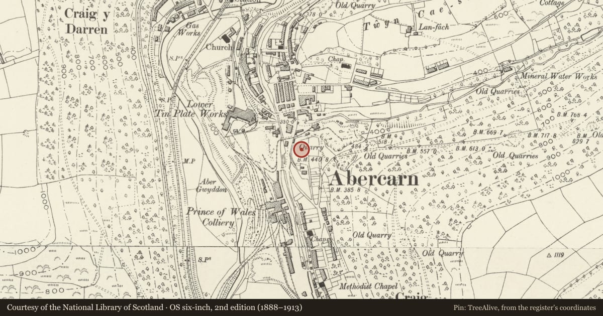
Slide toward Today to fade the historical sheet and see the modern map underneath.
David Rumsey Map Collection, Stanford LibrariesDavid Rumsey Map Collection, Stanford LibrariesDavid Rumsey Map Collection, Stanford LibrariesDavid Rumsey Map Collection, Stanford LibrariesDavid Rumsey Map Collection, Stanford Libraries
5 historical maps cover this location, the earliest the 1636 map "Cornubia : Devonia, Somersetus, Dorcestria, Wiltonia, Glocestria ..." (David Rumsey Map Collection, Stanford Libraries).
Historical maps covering this location
- 1636 · Cornubia : Devonia, Somersetus, Dorcestria, Wiltonia, Glocestria ... (David Rumsey Map Collection, Stanford Libraries)
- 1637 · The fourth table of England. Cornub. Devonia, Somerset etc. (David Rumsey Map Collection, Stanford Libraries)
- 1895 · Sheet 11. Ordnance Survey of England and Wales. (David Rumsey Map Collection, Stanford Libraries)
- 1906 · 249 Newport (Hills) (David Rumsey Map Collection, Stanford Libraries)
- 1913 · Sheet 102. Newport. (David Rumsey Map Collection, Stanford Libraries)
Cadw's description
Location
Set in the sloping garden below the garden frontage of the house.
History
Probably contemporary with the house which was probably built around the time of the First World War. The paved area adjacent to the terraced steps was formerly a glasshouse with boiler house beneath.
Exterior
This feature consists of an asymmetrical stone staircase rising from a grassy terrace, formerly used for tennis, to the paved terrace fronting the house. Built of stone rubble, some rockfaced, with roughly dressed stone coping. The base, with swept sides, shallow coping stones and roughly dressed quoins, incorporates a segmental arched alcove with rough voussoirs which formerly held a seat. Two rounded approach steps to right, then the flight of steps returns behind the recess, then turns again to ascend the slope in 3 uneven sections, flanked by low walls with end piers.
Reason for designation
Listed as an interesting garden feature for group value with the house.
Nearby in the register
- The GablesDomesticunder 1 mi
- Charcoal Blast Furnace at AbercarnBlast Furnaceunder 1 mi
- Abercarn War MemorialReligious, Ritual and Funeraryunder 1 mi
- Welsh Presbyterian ChurchReligious, Ritual and Funeraryunder 1 mi
Other entries of the same register within about three miles of this one, by straight line.