Cof Cymru: National Historic Assets of Wales · Wales
Water pump
Llangeler, Carmarthenshire, Wales
A Grade II listed building in Drefach Felindre, Carmarthen, Llangeler, Carmarthenshire, designated on 15 August 2001.
The record
- Designation
- Listed building, Grade II
- Broad class
- Water Supply and Drainage
- Date of designation
- 15 August 2001
- Locality
- Drefach Felindre
- Town
- Carmarthen
- Community
- Llangeler
- Unitary authority
- Carmarthenshire
- Country
- Wales
- Coordinates
- 52.02136, -4.39959
- Cadw reference
- 25700
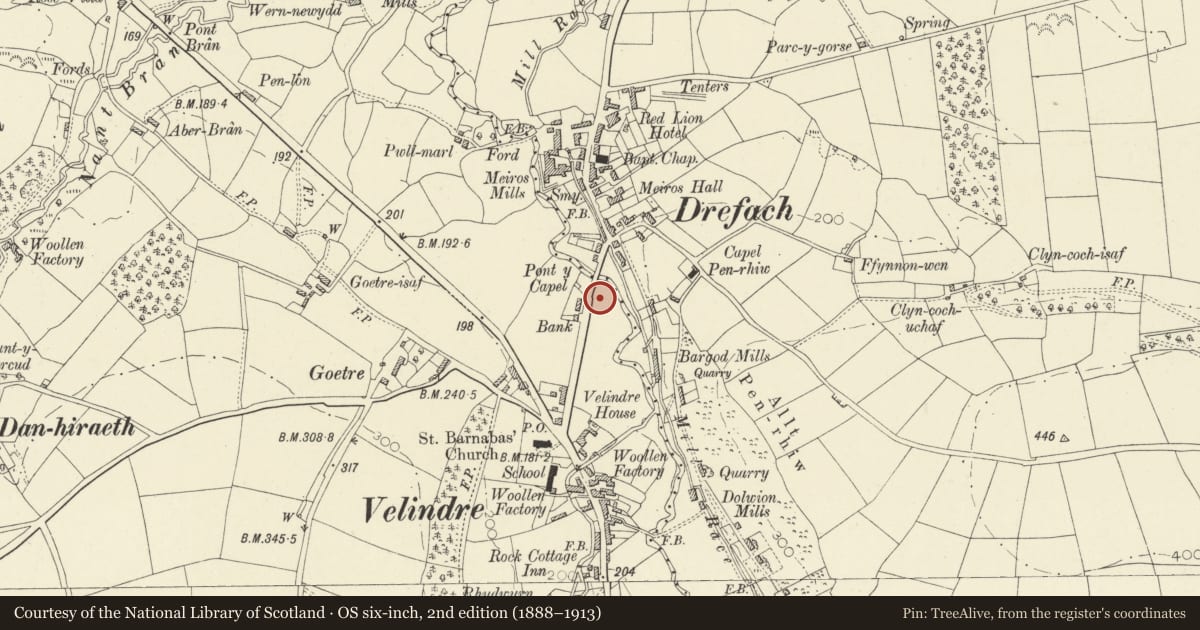
Slide toward Today to fade the historical sheet and see the modern map underneath.
David Rumsey Map Collection, Stanford LibrariesDavid Rumsey Map Collection, Stanford LibrariesDavid Rumsey Map Collection, Stanford LibrariesDavid Rumsey Map Collection, Stanford LibrariesDavid Rumsey Map Collection, Stanford Libraries
5 historical maps cover this location, the earliest the 1830 map "V.3:11-15:XV. Britisches Reich. A. Kon: England. b. Frstenthum Wales: Shire: 37-40" (David Rumsey Map Collection, Stanford Libraries).
Historical maps covering this location
- 1830 · V.3:11-15:XV. Britisches Reich. A. Kon: England. b. Frstenthum Wales: Shire: 37-40 (David Rumsey Map Collection, Stanford Libraries)
- 1860 · 41. Caermathen. (David Rumsey Map Collection, Stanford Libraries)
- 1891 · Sheet 10. Ordnance Survey of England and Wales. . (David Rumsey Map Collection, Stanford Libraries)
- 1898 · 211 Newcastle Emlyn (Hills) (David Rumsey Map Collection, Stanford Libraries)
- 1901 · Sheet 14. (David Rumsey Map Collection, Stanford Libraries)
Cadw's description
Location
Located in the corner of small, walled enclosure next to public conveniences.
History
Late C19 or early C20 water-pump.
Exterior
Painted cast iron water pump. Round shaft with 3 raised rings, wider fluted upper section, with wide, protruding rim. Light foliate decoration to spout joint and scrolled decoration to small, rounded crest for holding buckets. Wide rim to spout. Long, curved handle with ball end.
Reason for designation
Included as a good example of an increasingly rare Victorian street feature.
Nearby in the register
- Meiros Hall, including attached coach-house and stable range to rear.Domesticunder 1 mi
- GreenfieldDomesticunder 1 mi
- Velindre HouseDomesticunder 1 mi
- Church of St BarnabasReligious, Ritual and Funeraryunder 1 mi
Other entries of the same register within about three miles of this one, by straight line.