Cof Cymru: National Historic Assets of Wales · Wales
Bath-house at Lower Soughton Hall
Northop, Flintshire, Wales
A Grade II listed building in Soughton Hall, Mold, Northop, Flintshire, designated on 15 August 2001.
The record
- Designation
- Listed building, Grade II
- Broad class
- Gardens, Parks and Urban Spaces
- Date of designation
- 15 August 2001
- Locality
- Soughton Hall
- Town
- Mold
- Community
- Northop
- Unitary authority
- Flintshire
- Country
- Wales
- Coordinates
- 53.20305, -3.12701
- Cadw reference
- 25695
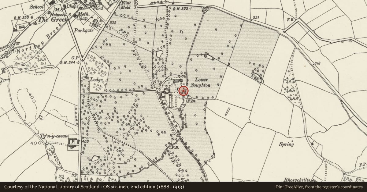
Slide toward Today to fade the historical sheet and see the modern map underneath.
David Rumsey Map Collection, Stanford LibrariesDavid Rumsey Map Collection, Stanford LibrariesDavid Rumsey Map Collection, Stanford LibrariesDavid Rumsey Map Collection, Stanford LibrariesLlyfrgell Genedlaethol Cymru – The National Library of Wales
5 historical maps cover this location, the earliest the 1795 map "To Sir Watkin Williams-Wynn Bart ... the map of the six counties of North Wales is most humbly inscribed by his obedient humble servant" (Llyfrgell Genedlaethol Cymru – The National Library of Wales).
Historical maps covering this location
- 1795 · To Sir Watkin Williams-Wynn Bart ... the map of the six counties of North Wales is most… (Llyfrgell Genedlaethol Cymru – The National Library of Wales)
- 1883 · Watershed map England, Wales 3. (David Rumsey Map Collection, Stanford Libraries)
- 1898 · 108 Flint (Hills) (David Rumsey Map Collection, Stanford Libraries)
- 1898 · 108 Flint (Outline) (David Rumsey Map Collection, Stanford Libraries)
- 1901 · Sheet 9 and 10. (David Rumsey Map Collection, Stanford Libraries)
Cadw's description
Location
Located on the E side of the gardens, which lie to the S of Lower Soughton Hall.
History
Bath-house or baptistery of unknown date, probably early-mid C19, and possibly contemporary with the house. In the spandrels above the entrance are the initials 'EML' and date '1710', but neither inscription appears to be original. The initials refer to Edward Lewis who lived at Lower Soughton; he was brother-in-law of Edward Conway who inherited the property in 1689. In 1832 Lower Soughton was described as having a fine well with an inscription 'EML 1710, but it is not clear whether this referred to the same structure.
Exterior
Roughly square structure of rubble stone, now roofless, the walls standing full-height. Openings with segmental heads and moulded stone surrounds. The entrance faces E; doorway to R with inscriptions to spandrels, 'EML' to L and '1710' to R. To the L of the doorway is a large window, below which is an opening partly below ground level, which is over an overflow channel.
Interior
Circular water-filled well to centre with 4 steps on S side. Surrounded by a flagstone floor. To N, S and W walls are shallow round-arched recesses with stone voussoirs and stone or slate sills.
Reason for designation
Listed as a good example of a Romantic garden structure, and for group value with Lower Soughton Hall.
Nearby in the register
- Lower Soughton HallDomesticunder 1 mi
- Lower Lodge to Soughton HallDomesticunder 1 mi
- Parkgate Farm Farmhouse and attached ShipponDomesticunder 1 mi
- Lislea HouseDomesticunder 1 mi
Other entries of the same register within about three miles of this one, by straight line.