Cof Cymru: National Historic Assets of Wales · Wales
Groeswen
Erwood, Powys, Wales
A Grade II listed building in Gwenddwr, Builth Wells, Erwood, Powys, designated on 3 August 2001.
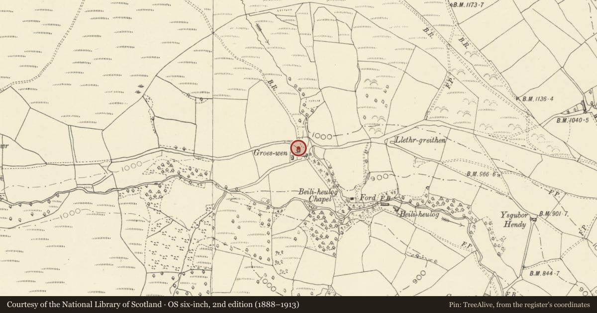
The record
- Designation
- Listed building, Grade II
- Broad class
- Domestic
- Date of designation
- 3 August 2001
- Locality
- Gwenddwr
- Town
- Builth Wells
- Community
- Erwood
- Unitary authority
- Powys
- Country
- Wales
- Coordinates
- 52.08289, -3.39301
- Cadw reference
- 25669
Slide toward Today to fade the historical sheet and see the modern map underneath.
David Rumsey Map Collection, Stanford LibrariesDavid Rumsey Map Collection, Stanford LibrariesDavid Rumsey Map Collection, Stanford LibrariesDavid Rumsey Map Collection, Stanford LibrariesDavid Rumsey Map Collection, Stanford Libraries
5 historical maps cover this location, the earliest the 1608 map "(13) Cambriae Typus." (David Rumsey Map Collection, Stanford Libraries).
Historical maps covering this location
- 1608 · (13) Cambriae Typus. (David Rumsey Map Collection, Stanford Libraries)
- 1636 · Cornubia : Devonia, Somersetus, Dorcestria, Wiltonia, Glocestria ... (David Rumsey Map Collection, Stanford Libraries)
- 1637 · Particular description of Wales. Cambria seu Wallia (David Rumsey Map Collection, Stanford Libraries)
- 1899 · 196 Builth (Hills) (David Rumsey Map Collection, Stanford Libraries)
- 1901 · Sheet 14. (David Rumsey Map Collection, Stanford Libraries)
Cadw's description
Location
Situated in an isolated position in the Nant yr Offeiriad valley some 2 km W of Gwenddwr village.
History
Farmhouse, earlier C19. Marked on the Gwenddwr Tithe map of 1840 as a holding of 77 acres (31.16 hectares) owned by Arthur Maenamara and occupied by Elizabeth Jones.
Exterior
Farmhouse, whitewashed rubble stone with slate close-eaved roof and rendered end stacks. Two-storey, three-window range of 9-pane windows and board door set to right of centre not aligned with window above. Painted cambered brick heads, stone sills. Windows have hinged opening top-lights. Big lean-to on left end with 4-pane small window over 9-pane window and stone stack on side wall. Outshut rear to main house, the rear wall collapsed (2000), entry into both outshut and lean-to under lean-to porch in re-entrant angle. Right end wall has loft light.
Interior
Interior not inspected.
Reason for designation
Included as a substantial traditional farmhouse of the late Georgian type.
Nearby in the register
- Capel Beili HeulogReligious, Ritual and Funeraryunder 1 mi
- Gwenddwr Deserted VillageDeserted Rural Settlement1 mi
- Church of St DubriciusReligious, Ritual and Funerary1 mi
- Castle Earthwork 200m S of Coed CaeauRingwork2 mi
Other entries of the same register within about three miles of this one, by straight line.