Cof Cymru: National Historic Assets of Wales · Wales
Barn range at Tyleheulog
Erwood, Powys, Wales
A Grade II listed building in Crickadarn, Builth Wells, Erwood, Powys, designated on 3 August 2001.
The record
- Designation
- Listed building, Grade II
- Broad class
- Agriculture and Subsistence
- Date of designation
- 3 August 2001
- Locality
- Crickadarn
- Town
- Builth Wells
- Community
- Erwood
- Unitary authority
- Powys
- Country
- Wales
- Coordinates
- 52.06021, -3.33081
- Cadw reference
- 25667
Slide toward Today to fade the historical sheet and see the modern map underneath.
David Rumsey Map Collection, Stanford LibrariesDavid Rumsey Map Collection, Stanford LibrariesDavid Rumsey Map Collection, Stanford LibrariesDavid Rumsey Map Collection, Stanford LibrariesDavid Rumsey Map Collection, Stanford Libraries
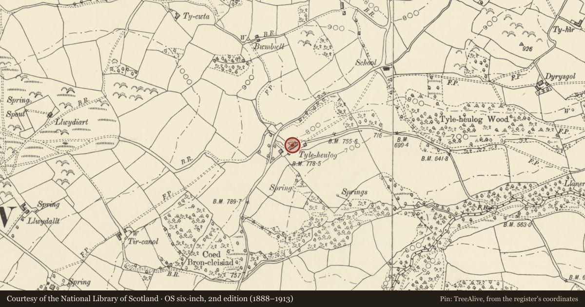
5 historical maps cover this location, the earliest the 1608 map "(13) Cambriae Typus." (David Rumsey Map Collection, Stanford Libraries).
Historical maps covering this location
- 1608 · (13) Cambriae Typus. (David Rumsey Map Collection, Stanford Libraries)
- 1636 · Cornubia : Devonia, Somersetus, Dorcestria, Wiltonia, Glocestria ... (David Rumsey Map Collection, Stanford Libraries)
- 1856 · 42. Brecon. (David Rumsey Map Collection, Stanford Libraries)
- 1898 · 197 Hay (Hills) (David Rumsey Map Collection, Stanford Libraries)
- 1901 · Sheet 14. (David Rumsey Map Collection, Stanford Libraries)
Cadw's description
Location
Situated just E of the farmhouse fronting on lane running E to Trericket.
History
Range of outbuildings, early to mid C19, shown on the Crickadarn Tithe map of 1842.
Exterior
Range of outbuildings, primarily a large earlier C19 rubble stone barn with stone-tiled roof, full-height double doors and 2 rows of 2 vent loops to left, the right side obscured by an added lean-to. Rear has similar vent loops to right and rear door blocked by single storey outbuilding at right angles.
Additions each end, to left a low lofted building with weatherboard front, slate roof and stone end wall with outside steps to loft door. Stone rear wall. C20 weatherboard to front with 2 doors.
To right with slightly lower slate roof is large late C19 lofted range, rubble stone with red-brick framed openings with cambered heads. Two loft lights one with cambered head, the other slightly higher under eaves. Ground floor has 3 doors close-spaced and four more widely spaced.
Interior
Interior not available for inspection.
Reason for designation
Included as an extensive range of early and late C19 outbuildings, of group value with the farmhouse at Tyleheulog.
Nearby in the register
- TyleheulogDomesticunder 1 mi
- Crickadarn CampEnclosureunder 1 mi
- South CottageDomesticunder 1 mi
- Hebron Congregational ChapelReligious, Ritual and Funeraryunder 1 mi
Other entries of the same register within about three miles of this one, by straight line.