Cof Cymru: National Historic Assets of Wales · Wales
Gelli Graean
Pennal, Gwynedd, Wales
A Grade II listed building in Cwrt, Machynlleth, Pennal, Gwynedd, designated on 3 August 2001.
The record
- Designation
- Listed building, Grade II
- Broad class
- Domestic
- Date of designation
- 3 August 2001
- Locality
- Cwrt
- Town
- Machynlleth
- Community
- Pennal
- Unitary authority
- Gwynedd
- Country
- Wales
- Coordinates
- 52.58328, -3.94367
- Cadw reference
- 25614
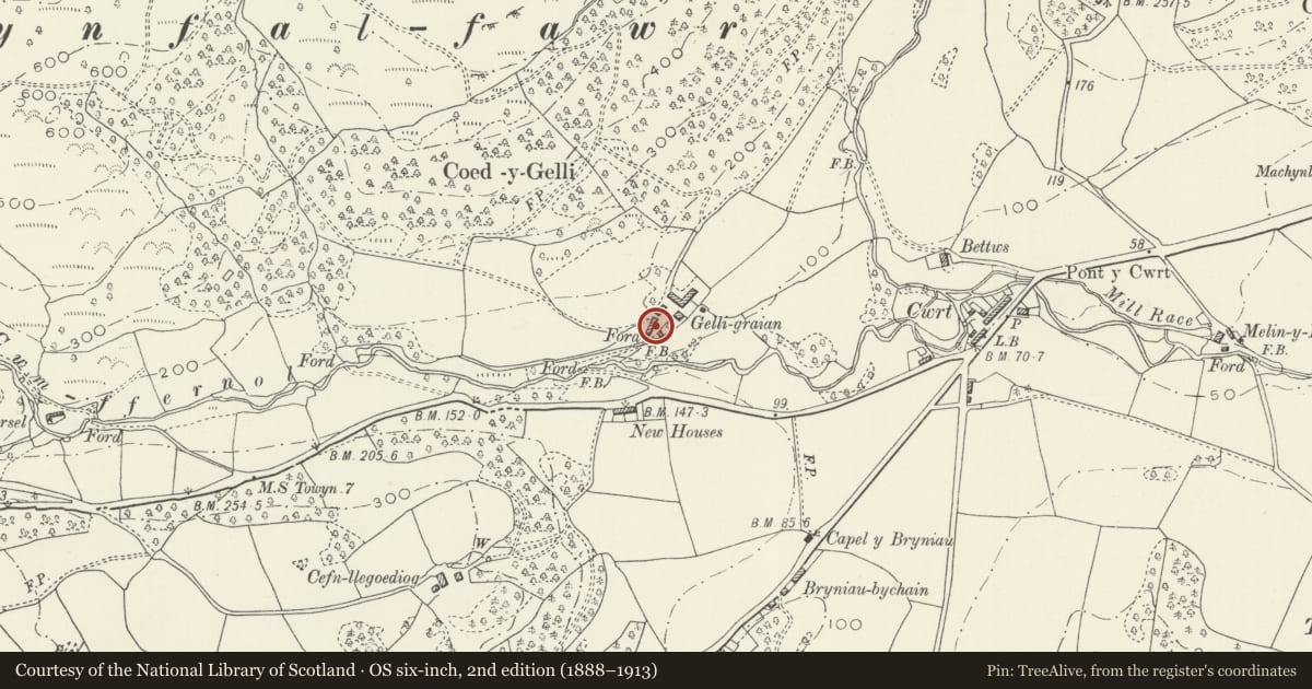
Slide toward Today to fade the historical sheet and see the modern map underneath.
David Rumsey Map Collection, Stanford LibrariesDavid Rumsey Map Collection, Stanford LibrariesDavid Rumsey Map Collection, Stanford LibrariesLlyfrgell Genedlaethol Cymru – The National Library of WalesDavid Rumsey Map Collection, Stanford Libraries
5 historical maps cover this location, the earliest the 1795 map "To Sir Watkin Williams-Wynn Bart ... the map of the six counties of North Wales is most humbly inscribed by his obedient humble servant" (Llyfrgell Genedlaethol Cymru – The National Library of Wales).
Historical maps covering this location
- 1795 · To Sir Watkin Williams-Wynn Bart ... the map of the six counties of North Wales is most… (Llyfrgell Genedlaethol Cymru – The National Library of Wales)
- 1830 · V.3:11-15:XV. Britisches Reich. A. Kon: England. b. Frstenthum Wales: Shire: 37-40 (David Rumsey Map Collection, Stanford Libraries)
- 1883 · Watershed map England, Wales 3. (David Rumsey Map Collection, Stanford Libraries)
- 1896 · Sheet 7. Ordnance Survey of England and Wales. (David Rumsey Map Collection, Stanford Libraries)
- 1901 · Sheet 9 and 10. (David Rumsey Map Collection, Stanford Libraries)
Cadw's description
Location
Located above Nant Cwm-ffernol, approx 5km W of the hamlet of Cwrt and reached by a farm road from the Cwm Maethlon road.
History
Substantial gentry farmhouse, probably built to its present form c1800, apparently built at the same time as the nearby Esgair Weddan, for children of the Talgarth Hall family. The two houses are of very similar design.
Exterior
Large farmhouse. 3-storeyed, 3-window range, with lower service buildings in line to either end. Rubble stone with slate roofs with gable end stacks. Long symmetrically arranged 3-window range slightly offset to left. Central entrance flanked by small-paned sash windows, with 3 similar windows to first floor. Low attic storey has 2-light casements immediately below eaves.
Interior
Not inspected.
Reason for designation
Listed as a good gentry farmhouse retaining original character.
Nearby in the register
- Esgair WeddanDomesticunder 1 mi
- MilepostTransportunder 1 mi
- Plas TalgarthDomesticunder 1 mi
- Tomen Las Castle MoundMotteunder 1 mi
Other entries of the same register within about three miles of this one, by straight line.