Cof Cymru: National Historic Assets of Wales · Wales
Stable at Faenol Fach
Trelawnyd and Gwaenysgor, Flintshire, Wales
A Grade II listed building in Trelawnyd, Trelawnyd and Gwaenysgor, Flintshire, designated on 18 July 2001.
The record
- Designation
- Listed building, Grade II
- Broad class
- Domestic
- Date of designation
- 18 July 2001
- Locality
- Trelawnyd
- Community
- Trelawnyd and Gwaenysgor
- Unitary authority
- Flintshire
- Country
- Wales
- Coordinates
- 53.30601, -3.36757
- Cadw reference
- 25588
Slide toward Today to fade the historical sheet and see the modern map underneath.
David Rumsey Map Collection, Stanford LibrariesDavid Rumsey Map Collection, Stanford LibrariesLlyfrgell Genedlaethol Cymru – The National Library of WalesNational Library of ScotlandNational Library of Scotland
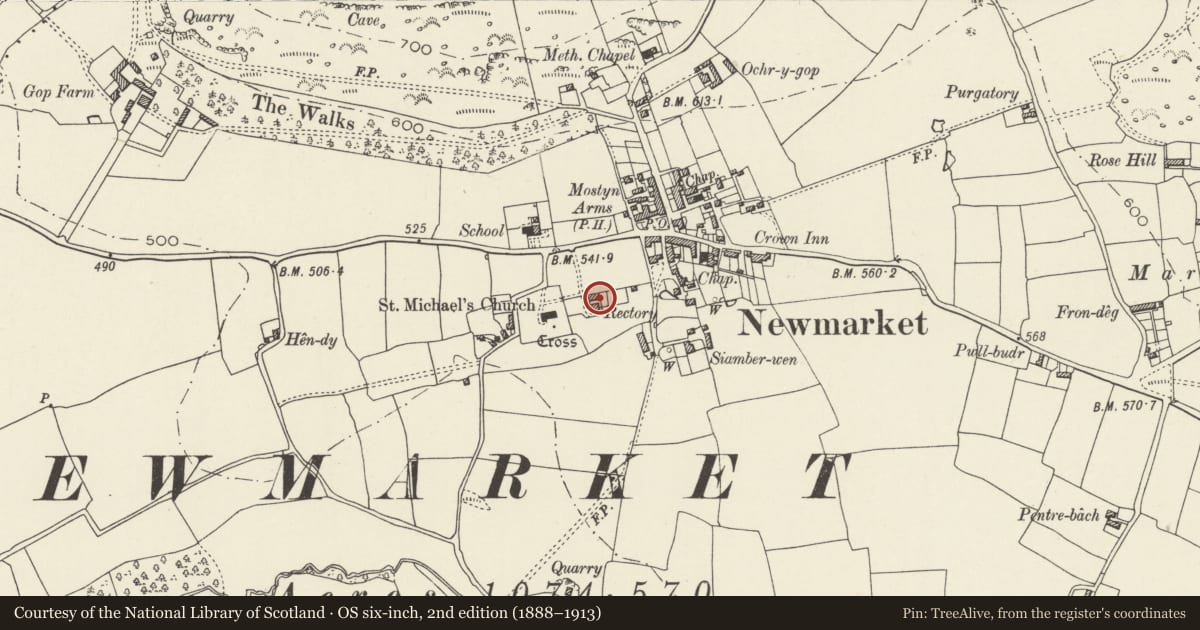
5 historical maps cover this location, the earliest the 1795 map "To Sir Watkin Williams-Wynn Bart ... the map of the six counties of North Wales is most humbly inscribed by his obedient humble servant" (Llyfrgell Genedlaethol Cymru – The National Library of Wales).
Historical maps covering this location
- 1795 · To Sir Watkin Williams-Wynn Bart ... the map of the six counties of North Wales is most… (Llyfrgell Genedlaethol Cymru – The National Library of Wales)
- 1883 · Watershed map England, Wales 3. (David Rumsey Map Collection, Stanford Libraries)
- 1885 · OS One-Inch (Hills) 1885-1903 (National Library of Scotland)
- 1901 · Sheet 9 and 10. (David Rumsey Map Collection, Stanford Libraries)
- 1930 · OS Popular Edition 1919-1947 (National Library of Scotland)
Cadw's description
Location
On the N side of the house.
History
The house was built in 1842 as the vicarage. The stable is contemporary and is shown with the house on the 1844 Tithe map.
Exterior
A rubble-stone stable with hipped slate roof. Original openings have mainly segmental heads with stone voussoirs. Facing S to a small yard and the house are replaced double doors at the R end, L of which is a replaced 2-light window beneath a wood-vented loft opening. Next L is a stable door, then double doors under a lintel concealed by wooden fascia. An added lean-to is at the L end. Against the R end is an added loose box with round-headed doorway and stable door, and a small replaced window in its end wall. The rear of the main range has a boarded door to the centre and a loft window inserted to the R in the late C19.
Reason for designation
Listed as a C19 stable range retaining original character, and for group value with the house.
Nearby in the register
- Faenol FachDomesticunder 1 mi
- Row of 7 tombs against E chancel wall of Church of St MichaelReligious, Ritual and Funeraryunder 1 mi
- Lloyd family tombs against S chancel wall of Church of St MichaelReligious, Ritual and Funeraryunder 1 mi
- Church of St Michael & All AngelsReligious, Ritual and Funeraryunder 1 mi
Other entries of the same register within about three miles of this one, by straight line.