Cof Cymru: National Historic Assets of Wales · Wales
North Churchyard Cross at Church of St Peter
Goetre Fawr, Monmouthshire, Wales
A Grade II listed building in Goetre, Pontypool, Goetre Fawr, Monmouthshire, designated on 18 July 2001.
The record
- Designation
- Listed building, Grade II
- Broad class
- Religious, Ritual and Funerary
- Date of designation
- 18 July 2001
- Locality
- Goetre
- Town
- Pontypool
- Community
- Goetre Fawr
- Unitary authority
- Monmouthshire
- Country
- Wales
- Coordinates
- 51.74804, -2.97580
- Cadw reference
- 25562
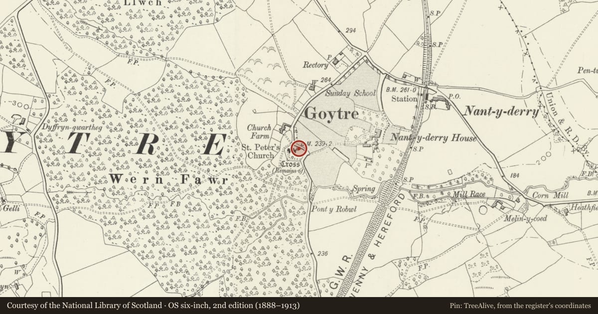
Slide toward Today to fade the historical sheet and see the modern map underneath.
David Rumsey Map Collection, Stanford LibrariesDavid Rumsey Map Collection, Stanford LibrariesDavid Rumsey Map Collection, Stanford LibrariesDavid Rumsey Map Collection, Stanford LibrariesDavid Rumsey Map Collection, Stanford Libraries
5 historical maps cover this location, the earliest the 1636 map "Cornubia : Devonia, Somersetus, Dorcestria, Wiltonia, Glocestria ..." (David Rumsey Map Collection, Stanford Libraries).
Historical maps covering this location
- 1636 · Cornubia : Devonia, Somersetus, Dorcestria, Wiltonia, Glocestria ... (David Rumsey Map Collection, Stanford Libraries)
- 1895 · Sheet 11. Ordnance Survey of England and Wales. (David Rumsey Map Collection, Stanford Libraries)
- 1898 · 232 Abergavenny (Hills) (David Rumsey Map Collection, Stanford Libraries)
- 1898 · 232 Abergavenny (Outline) (David Rumsey Map Collection, Stanford Libraries)
- 1913 · Sheet 102. Newport. (David Rumsey Map Collection, Stanford Libraries)
Cadw's description
Location
On the north side of the chancel of Church of St Peter.
History
A part medieval churchyard cross rebuilt in c1932.
Exterior
Stone built cross with a base of three square diminishing steps of thin coursed rubble with paving stone tops, these date from c1932. They support a probably C15 socket stone that carries a square shaft quickly tapering to octagonal, in turn supporting a cross. Only the bottom of this shaft is medieval. Copper plate inscription fixed to the socket stone. 'This churchyard cross was rebuilt on its original base in commemmoration of the faithful services of the Rev. Henry Charles Penoyre Belcher MA. Rector of this parish 1919-1932'.
Reason for designation
Included as the interesting remains of a medieval churchyard cross rebuilt in c1932.
Nearby in the register
- Church of St PeterReligious, Ritual and Funeraryunder 1 mi
- South Churchyard Cross at Church of St PeterReligious, Ritual and Funeraryunder 1 mi
- Obelisk to Marie Witherington in Churchyard of Church of St PeterCommemorativeunder 1 mi
- Church FarmhouseDomesticunder 1 mi
Other entries of the same register within about three miles of this one, by straight line.