Cof Cymru: National Historic Assets of Wales · Wales
Pair of Mileposts in W boundary wall to Lidl car park
Heath, Cardiff, Wales
A Grade II listed building in Birchgrove, Cardiff, Heath, designated on 18 July 2001.
The record
- Designation
- Listed building, Grade II
- Broad class
- Transport
- Date of designation
- 18 July 2001
- Locality
- Birchgrove
- Town
- Cardiff
- Community
- Heath
- Unitary authority
- Cardiff
- Country
- Wales
- Coordinates
- 51.51975, -3.20120
- Cadw reference
- 25525
Slide toward Today to fade the historical sheet and see the modern map underneath.
David Rumsey Map Collection, Stanford LibrariesDavid Rumsey Map Collection, Stanford LibrariesDavid Rumsey Map Collection, Stanford LibrariesDavid Rumsey Map Collection, Stanford LibrariesDavid Rumsey Map Collection, Stanford Libraries
5 historical maps cover this location, the earliest the 1636 map "Cornubia : Devonia, Somersetus, Dorcestria, Wiltonia, Glocestria ..." (David Rumsey Map Collection, Stanford Libraries).
Historical maps covering this location
- 1636 · Cornubia : Devonia, Somersetus, Dorcestria, Wiltonia, Glocestria ... (David Rumsey Map Collection, Stanford Libraries)
- 1865 · England and Wales. England No. 6. (David Rumsey Map Collection, Stanford Libraries)
- 1895 · Sheet 11. Ordnance Survey of England and Wales. (David Rumsey Map Collection, Stanford Libraries)
- 1898 · 263 Cardiff (Hills) (David Rumsey Map Collection, Stanford Libraries)
- 1913 · Sheet 110. Cardiff & Mouth of the Severn. (David Rumsey Map Collection, Stanford Libraries)
Cadw's description
Location
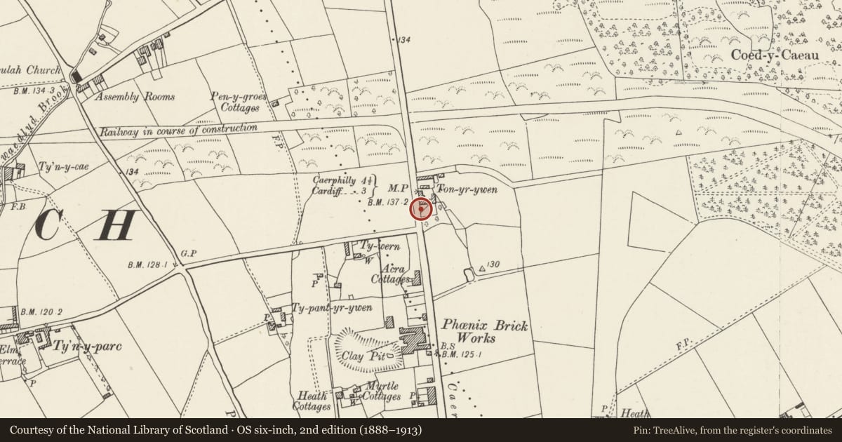
Situated to rear of pavement and set into low modern brick wall topped by railings along W side of supermarket car park.
History
1830s cast-iron milepost dating from the turnpike trust improvements to Cardiff-Caerphilly-Merthyr road.
Probably later C18 stone milepost on same road transport route.
Exterior
Two mileposts, one of cast-iron to left and the other of roughly dressed stonework to right, set into modern concrete and probably resited from elsewhere in Caerphilly Road. Triangular cast-iron post with sloping top and rolled edge mouldings bears raised lettering: "ROATH 3 1/4" in triangular head. N facet of upright inscribed: "CARDIFF 3 Miles" and S facet: "CAERPH-ILLY 4 1/4 Miles".
Earlier, battered rectangular stone (about 1m high) bears incised but eroded lettering possibly reading: "From Cardiff ... Miles".
Reason for designation
Though the milestone is very eroded and both have been resited, these two mile markers are of special interest as illustrating the progressive history of road transport in Glamorgan.
Nearby in the register
- Nos. 1-5 Pen-y-dre (odds), including No. 227 Pant Bach RoadDomesticunder 1 mi
- Nos. 7-13 Pen-y-dre (odds)Domesticunder 1 mi
- Nos. 15-19 Pen-y-dre (odds)Domesticunder 1 mi
- Nos. 2-8 Pen-y-dre (evens)Domesticunder 1 mi
Other entries of the same register within about three miles of this one, by straight line.