Cof Cymru: National Historic Assets of Wales · Wales
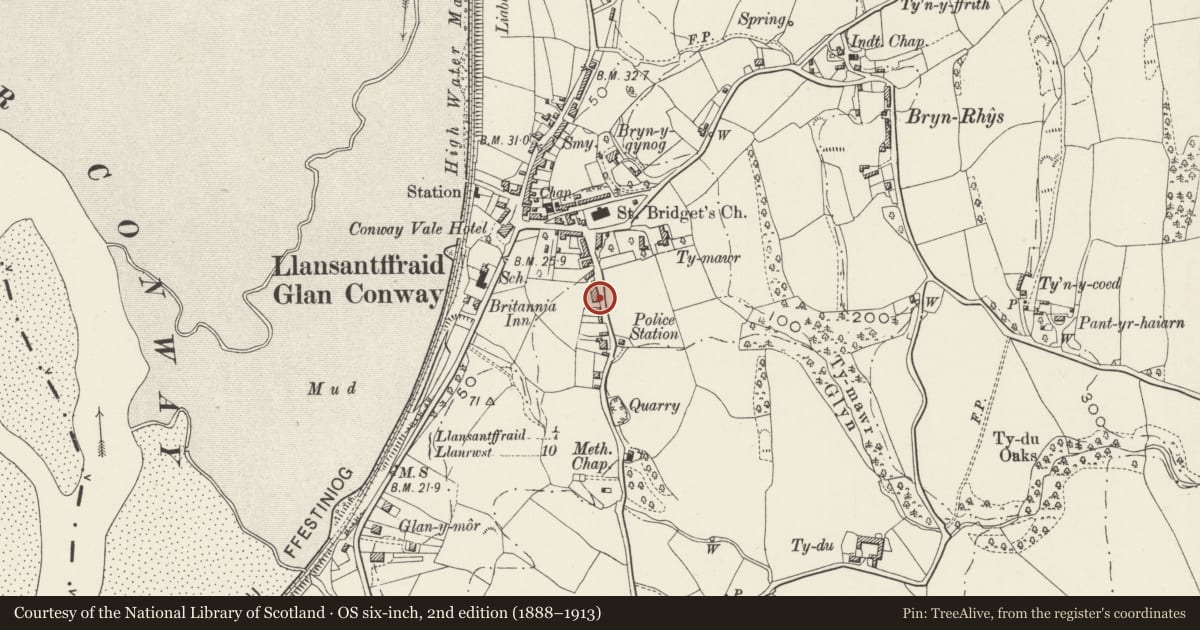
24 Top Llan Road
Llansanffraid Glan Conwy, Conwy, Wales
A Grade II listed building in Llansanffraid Glan Conwy, Conwy, designated on 14 February 1974.
The record
- Designation
- Listed building, Grade II
- Broad class
- Domestic
- Date of designation
- 14 February 1974
- Locality
- Llansanffraid Glan Conwy
- Community
- Llansanffraid Glan Conwy
- Unitary authority
- Conwy
- Country
- Wales
- Coordinates
- 53.26727, -3.79487
- Cadw reference
- 255
Slide toward Today to fade the historical sheet and see the modern map underneath.
David Rumsey Map Collection, Stanford LibrariesDavid Rumsey Map Collection, Stanford LibrariesLlyfrgell Genedlaethol Cymru – The National Library of WalesDavid Rumsey Map Collection, Stanford LibrariesNational Library of Scotland
5 historical maps cover this location, the earliest the 1795 map "To Sir Watkin Williams-Wynn Bart ... the map of the six counties of North Wales is most humbly inscribed by his obedient humble servant" (Llyfrgell Genedlaethol Cymru – The National Library of Wales).
Historical maps covering this location
- 1795 · To Sir Watkin Williams-Wynn Bart ... the map of the six counties of North Wales is most… (Llyfrgell Genedlaethol Cymru – The National Library of Wales)
- 1830 · V.3:11-15:XV. Britisches Reich. A. Kon: England. b. Frstenthum Wales: Shire: 37-40 (David Rumsey Map Collection, Stanford Libraries)
- 1883 · Watershed map England, Wales 3. (David Rumsey Map Collection, Stanford Libraries)
- 1901 · Sheet 9 and 10. (David Rumsey Map Collection, Stanford Libraries)
- 1930 · OS Popular Edition 1919-1947 (National Library of Scotland)
Cadw's description
Location
On the hill leading south out of Llansanffraid Glan Conwy. Set above the road and detached to left.
History
The character derives from an early C19 remodelling but the asymmetrical placement of the openings indicates earlier origins and is said to have been an inn in the C17.
Exterior
2-storey, 2-window, painted roughcast front with slate roof and end chimney stacks; openings offset to right. 16-pane sash windows are horned except for that to ground floor left; all are set in simple classical stuccoed surrounds. The 1st floor windows break the eaves under gables with pendants and finials. Central round-arched doorway with fanlight and panelled door. Cross-wing to rear.
Reason for designation
Listed for the well-preserved historic character of this village house.
Nearby in the register
- Church HouseReligious, Ritual and Funeraryunder 1 mi
- Plas TirionDomesticunder 1 mi
- Parish Church of St FfraidReligious, Ritual and Funeraryunder 1 mi
- Welsh Methodist ChapelReligious, Ritual and Funeraryunder 1 mi
Other entries of the same register within about three miles of this one, by straight line.