Cof Cymru: National Historic Assets of Wales · Wales
Old house at Trefenty
St. Clears, Carmarthenshire, Wales
A Grade II listed building in Trefenty, Carmarthen, St. Clears, Carmarthenshire, designated on 11 June 2001.
The record
- Designation
- Listed building, Grade II
- Broad class
- Domestic
- Date of designation
- 11 June 2001
- Locality
- Trefenty
- Town
- Carmarthen
- Community
- St. Clears
- Unitary authority
- Carmarthenshire
- Country
- Wales
- Coordinates
- 51.79503, -4.46901
- Cadw reference
- 25490
Slide toward Today to fade the historical sheet and see the modern map underneath.
David Rumsey Map Collection, Stanford LibrariesDavid Rumsey Map Collection, Stanford LibrariesDavid Rumsey Map Collection, Stanford LibrariesDavid Rumsey Map Collection, Stanford LibrariesDavid Rumsey Map Collection, Stanford Libraries
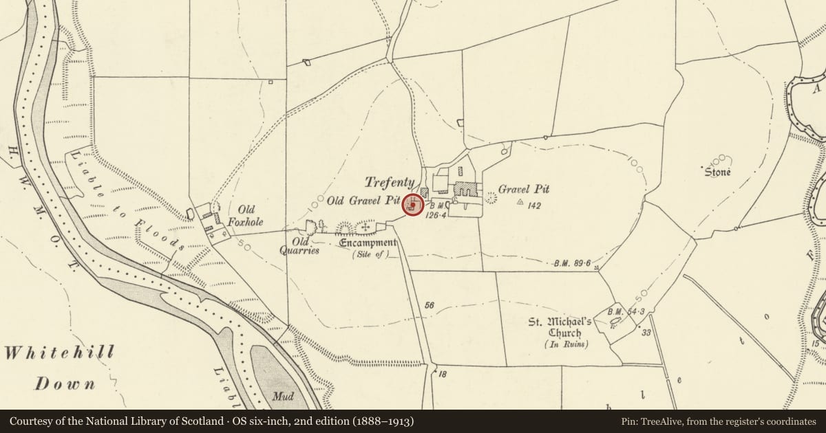
5 historical maps cover this location, the earliest the 1636 map "Cornubia : Devonia, Somersetus, Dorcestria, Wiltonia, Glocestria ..." (David Rumsey Map Collection, Stanford Libraries).
Historical maps covering this location
- 1636 · Cornubia : Devonia, Somersetus, Dorcestria, Wiltonia, Glocestria ... (David Rumsey Map Collection, Stanford Libraries)
- 1860 · 41. Caermathen. (David Rumsey Map Collection, Stanford Libraries)
- 1891 · Sheet 10. Ordnance Survey of England and Wales. . (David Rumsey Map Collection, Stanford Libraries)
- 1898 · 229 Carmarthen (Hills) (David Rumsey Map Collection, Stanford Libraries)
- 1901 · Sheet 14. (David Rumsey Map Collection, Stanford Libraries)
Cadw's description
Location
Situated in grassed enclosure immediately N of Trefenty.
History
Probable former estate farmhouse at Trefenty, possibly C18 altered in C19.
Exterior
Former estate farmhouse of 2 storeys, in whitewashed rubble stone with large quoins to angles, red brick heads and dressings to openings, slated roof and red brick end stacks. Long facade with two gabled dormers breaking eaves at sill level, paired casements to left, missing to right. Ground floor has central door with window each side under attic dormers and a third window to extreme right. All openings boarded or replaced with late C20 12-pane windows. Evidence of upper storey windows being raised as blocked openings are visible below the present slate sills. R gable has blocked ground floor doorway L of centre.
Interior
Not inspected. Derelict at the time of inspection.
Reason for designation
Included as a traditional Carmarthenshire farmhouse, a secondary dwelling on the farmstead at Trefenty, and part of a group on this important gentry farm.
Nearby in the register
- TrefentyDomesticunder 1 mi
- Range of outbuidings E of Trefenty farmhouseAgriculture and Subsistenceunder 1 mi
- Trefenty Mound and Bailey CastleMotte and Baileyunder 1 mi
- Ruins of former St Michael's Parish ChurchReligious, Ritual and Funeraryunder 1 mi
Other entries of the same register within about three miles of this one, by straight line.