Cof Cymru: National Historic Assets of Wales · Wales
Pentairrhiw
Llanwinio, Carmarthenshire, Wales
A Grade II listed building in Gellywen, Carmarthen, Llanwinio, Carmarthenshire, designated on 7 June 2001.
The record
- Designation
- Listed building, Grade II
- Broad class
- Domestic
- Date of designation
- 7 June 2001
- Locality
- Gellywen
- Town
- Carmarthen
- Community
- Llanwinio
- Unitary authority
- Carmarthenshire
- Country
- Wales
- Coordinates
- 51.88875, -4.51247
- Cadw reference
- 25470
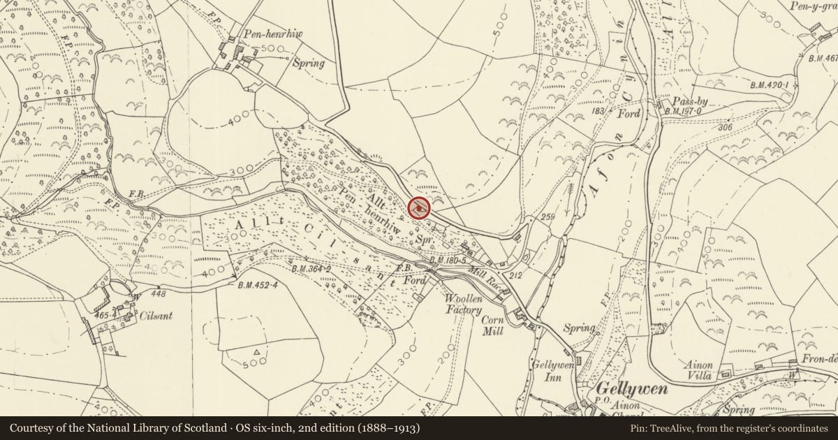
Slide toward Today to fade the historical sheet and see the modern map underneath.
David Rumsey Map Collection, Stanford LibrariesDavid Rumsey Map Collection, Stanford LibrariesDavid Rumsey Map Collection, Stanford LibrariesDavid Rumsey Map Collection, Stanford LibrariesDavid Rumsey Map Collection, Stanford Libraries
5 historical maps cover this location, the earliest the 1636 map "Cornubia : Devonia, Somersetus, Dorcestria, Wiltonia, Glocestria ..." (David Rumsey Map Collection, Stanford Libraries).
Historical maps covering this location
- 1636 · Cornubia : Devonia, Somersetus, Dorcestria, Wiltonia, Glocestria ... (David Rumsey Map Collection, Stanford Libraries)
- 1860 · 41. Caermathen. (David Rumsey Map Collection, Stanford Libraries)
- 1891 · Sheet 10. Ordnance Survey of England and Wales. . (David Rumsey Map Collection, Stanford Libraries)
- 1898 · 211 Newcastle Emlyn (Hills) (David Rumsey Map Collection, Stanford Libraries)
- 1901 · Sheet 14. (David Rumsey Map Collection, Stanford Libraries)
Cadw's description
Location
Situated on the SW side of a minor road some 500m NW of the centre of Gellywen village.
History
Small single storey cottage, probably earlier to mid C19. Its position immediately adjacent to the road suggests possible origins as a wayside encroachment.
Exterior
Cottage, whitewashed rubble stone with corrugated iron roof and brick end stacks. Single storey and attic, double fronted with centre board door with strap hinges between two small square 9-pane windows. Two gabled dormers with 6-pane pivot windows. C20 small timber porch. Small outbuilding to right with one C20 window. C20 added lean-to to rear.
Interior
Interior not available for inspection.
Reason for designation
Included as a surviving example of the small lofted cottage, once typical of the region, now rare.
Nearby in the register
- CilsantDomesticunder 1 mi
- Range of outbuildings at CilsantAgriculture and Subsistenceunder 1 mi
- Crug y Deyrn Burial ChamberRound Barrow1 mi
- Capel y Graig and attached railings and gatesReligious, Ritual and Funerary2 mi
Other entries of the same register within about three miles of this one, by straight line.