Cof Cymru: National Historic Assets of Wales · Wales
25 Bodafon Street
Llandudno, Conwy, Wales
A Grade II listed building in Llandudno, Conwy, designated on 16 March 1976.
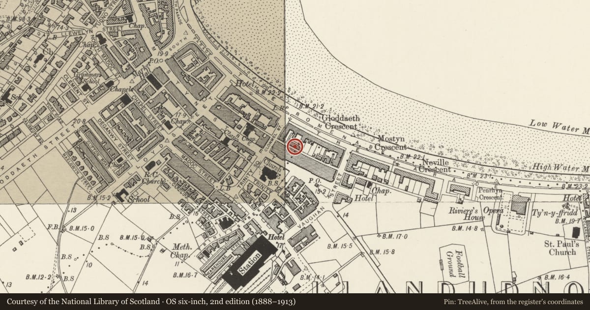
The record
- Designation
- Listed building, Grade II
- Broad class
- Domestic
- Date of designation
- 16 March 1976
- Locality
- Llandudno
- Community
- Llandudno
- Unitary authority
- Conwy
- Country
- Wales
- Coordinates
- 53.32327, -3.82599
- Cadw reference
- 25463
Slide toward Today to fade the historical sheet and see the modern map underneath.
David Rumsey Map Collection, Stanford LibrariesDavid Rumsey Map Collection, Stanford LibrariesDavid Rumsey Map Collection, Stanford LibrariesNational Library of ScotlandNational Library of Scotland
5 historical maps cover this location, the earliest the 1883 map "Watershed map England, Wales 3." (David Rumsey Map Collection, Stanford Libraries).
Historical maps covering this location
- 1883 · Watershed map England, Wales 3. (David Rumsey Map Collection, Stanford Libraries)
- 1885 · OS One-Inch (Hills) 1885-1903 (National Library of Scotland)
- 1899 · 94 Beaumaris (Hills) (David Rumsey Map Collection, Stanford Libraries)
- 1901 · Sheet 9 and 10. (David Rumsey Map Collection, Stanford Libraries)
- 1930 · OS Popular Edition 1919-1947 (National Library of Scotland)
Cadw's description
Location
On line of street, about 20m from junction with Clonmel Street.
History
Mic C19 two storey row of houses.
Exterior
Three bays. Sash window with 3 panes over 6, with cambered head in each end first floor bay; blind centre first floor opening. On ground floor, a 12-pane sash window to right had, a flat arched doorway with deep reveals in centre and, to left hand, a tall round headed arch at entrance to passage.
Reason for designation
One of the two best preserved houses in a row of ten. Smaller houses to rear of The Parade. Group value.
Nearby in the register
- 26 Bodafon StreetDomesticunder 1 mi
- 4 Bodafon StreetDomesticunder 1 mi
- 5 Bodafon StreetDomesticunder 1 mi
- 3 Bodafon StreetDomesticunder 1 mi
Other entries of the same register within about three miles of this one, by straight line.