Cof Cymru: National Historic Assets of Wales · Wales
26&26a
Chepstow, Monmouthshire, Wales
A Grade II listed building in Chepstow, Monmouthshire, designated on 24 March 1975.
The record
- Designation
- Listed building, Grade II
- Broad class
- Commercial
- Date of designation
- 24 March 1975
- Locality
- Chepstow
- Town
- Chepstow
- Community
- Chepstow
- Unitary authority
- Monmouthshire
- Country
- Wales
- Coordinates
- 51.64146, -2.67590
- Cadw reference
- 2534
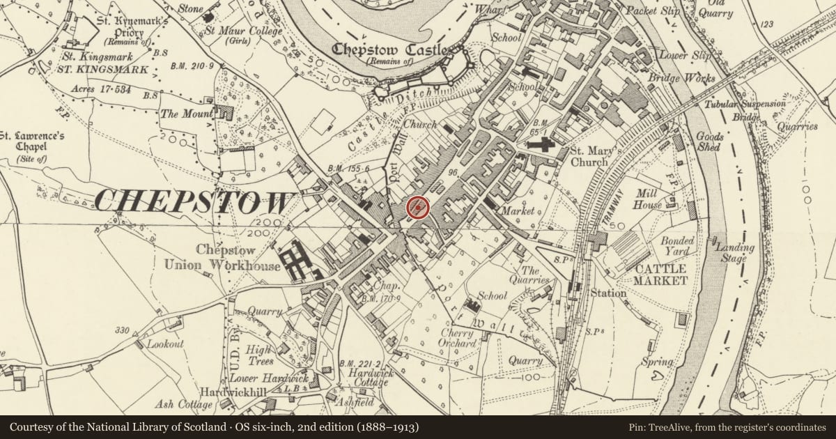
Slide toward Today to fade the historical sheet and see the modern map underneath.
David Rumsey Map Collection, Stanford LibrariesDavid Rumsey Map Collection, Stanford LibrariesDavid Rumsey Map Collection, Stanford LibrariesDavid Rumsey Map Collection, Stanford LibrariesDavid Rumsey Map Collection, Stanford Libraries
5 historical maps cover this location, the earliest the 1636 map "Cornubia : Devonia, Somersetus, Dorcestria, Wiltonia, Glocestria ..." (David Rumsey Map Collection, Stanford Libraries).
Historical maps covering this location
- 1636 · Cornubia : Devonia, Somersetus, Dorcestria, Wiltonia, Glocestria ... (David Rumsey Map Collection, Stanford Libraries)
- 1830 · V.3:11-15:XV.Britisches Reich. A. Kon: England. a. England ab sich: Shire:15-17, 33 (David Rumsey Map Collection, Stanford Libraries)
- 1895 · Sheet 11. Ordnance Survey of England and Wales. (David Rumsey Map Collection, Stanford Libraries)
- 1897 · 250 Chepstow (Outline) (David Rumsey Map Collection, Stanford Libraries)
- 1905 · 250 Chepstow (Hills) (David Rumsey Map Collection, Stanford Libraries)
Cadw's description
Location
High Street has ascending numbers downhill on S side to Beaufort Square then from number 24 uphill on N side.
History
Early C19 in its present form though signs of earlier fabric and a different orientation.
Exterior
Georgian building with two separate shopfronts and accommodation space above. Rendered with high coped parapet in front of concrete-tiled roof. Three storeys and basement. Three windows to top floor of 6/6-pane sashes with architraves, centre blocked; 5 windows to first floor of 8/12 sashes with architraves. Plate-glass shopfronts, projecting to right, flush and boarded-up to left with adjacent narrow panelled door retaining 4-pane overlight. Rear elevation to Bank Street has a 3-window range of sashes, central round-arched doorway flanked by boarded windows.
Interior
Cellar has reportedly a corbelled roof.
Reason for designation
Listed as a building within the historic centre retaining its basically Gerogian character. Numbers 23-28 form a continuous group. Group value with other listed buildings in High Street and Bank Street.
Nearby in the register
- 27 High StreetCommercialunder 1 mi
- 24&25 High StreetCommercialunder 1 mi
- 28&28aCommercialunder 1 mi
- Former Lloyds Bank ChambersCommercialunder 1 mi
Other entries of the same register within about three miles of this one, by straight line.