Cof Cymru: National Historic Assets of Wales · Wales
Barclays Bank
Llandudno, Conwy, Wales
A Grade II listed building in Llandudno, Conwy, designated on 6 June 2001.
The record
- Designation
- Listed building, Grade II
- Broad class
- Commercial
- Date of designation
- 6 June 2001
- Locality
- Llandudno
- Community
- Llandudno
- Unitary authority
- Conwy
- Country
- Wales
- Coordinates
- 53.32491, -3.83141
- Cadw reference
- 25320
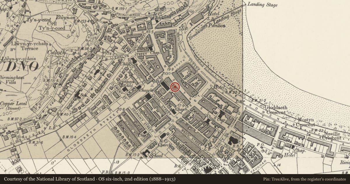
Slide toward Today to fade the historical sheet and see the modern map underneath.
David Rumsey Map Collection, Stanford LibrariesDavid Rumsey Map Collection, Stanford LibrariesDavid Rumsey Map Collection, Stanford LibrariesNational Library of ScotlandNational Library of Scotland
5 historical maps cover this location, the earliest the 1883 map "Watershed map England, Wales 3." (David Rumsey Map Collection, Stanford Libraries).
Historical maps covering this location
- 1883 · Watershed map England, Wales 3. (David Rumsey Map Collection, Stanford Libraries)
- 1885 · OS One-Inch (Hills) 1885-1903 (National Library of Scotland)
- 1899 · 94 Beaumaris (Hills) (David Rumsey Map Collection, Stanford Libraries)
- 1901 · Sheet 9 and 10. (David Rumsey Map Collection, Stanford Libraries)
- 1930 · OS Popular Edition 1919-1947 (National Library of Scotland)
Cadw's description
Location
Part of a group of buildings between corner with Lloyd Street and corner with Market Street.
History
Mid C20 bank.
Exterior
Three storey bank faced in Portland stone. Three window front to Mostyn Street. Shallow entablature with dentil cornice. Ashlar upper flors with rectangular windows with metal casements. Channelled ground floor with dentil cornice; round arched openings with keystones. Central doorway with classical doorframe flanked by windows with metal glazing.
Reason for designation
Listed for group value with adjacent listed buildings.
Nearby in the register
- 82 Mostyn StreetCommercialunder 1 mi
- 86 Mostyn Street including attached ClockCommercialunder 1 mi
- 80 Mostyn StreetCommercialunder 1 mi
- Group of 12 Lamp StandardsGardens, Parks and Urban Spacesunder 1 mi
Other entries of the same register within about three miles of this one, by straight line.