Cof Cymru: National Historic Assets of Wales · Wales
Entrance piers and flanking walls at Pantasaph Friary
Whitford, Flintshire, Wales
A Grade II listed building in Pantasaph, Holywell, Whitford, Flintshire, designated on 25 May 2001.
The record
- Designation
- Listed building, Grade II
- Broad class
- Religious, Ritual and Funerary
- Date of designation
- 25 May 2001
- Locality
- Pantasaph
- Town
- Holywell
- Community
- Whitford
- Unitary authority
- Flintshire
- Country
- Wales
- Coordinates
- 53.27423, -3.26071
- Cadw reference
- 25252
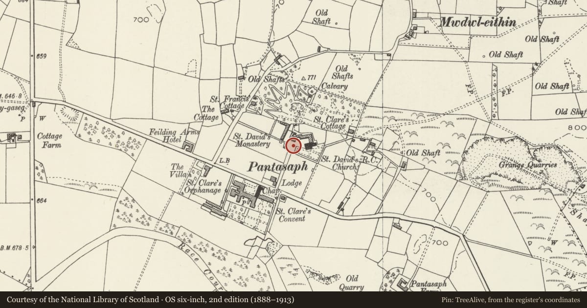
Slide toward Today to fade the historical sheet and see the modern map underneath.
David Rumsey Map Collection, Stanford LibrariesDavid Rumsey Map Collection, Stanford LibrariesDavid Rumsey Map Collection, Stanford LibrariesLlyfrgell Genedlaethol Cymru – The National Library of WalesDavid Rumsey Map Collection, Stanford Libraries
5 historical maps cover this location, the earliest the 1795 map "To Sir Watkin Williams-Wynn Bart ... the map of the six counties of North Wales is most humbly inscribed by his obedient humble servant" (Llyfrgell Genedlaethol Cymru – The National Library of Wales).
Historical maps covering this location
- 1795 · To Sir Watkin Williams-Wynn Bart ... the map of the six counties of North Wales is most… (Llyfrgell Genedlaethol Cymru – The National Library of Wales)
- 1830 · V.3:11-15:XV. Britisches Reich. A. Kon: England. b. Frstenthum Wales: Shire: 37-40 (David Rumsey Map Collection, Stanford Libraries)
- 1883 · Watershed map England, Wales 3. (David Rumsey Map Collection, Stanford Libraries)
- 1896 · 96 Liverpool (Hills) (David Rumsey Map Collection, Stanford Libraries)
- 1901 · Sheet 9 and 10. (David Rumsey Map Collection, Stanford Libraries)
Cadw's description
Location
Set back from the road and bounding an area of tarmac and gardens in front of the friary. The entrance is to the SW.
History
Probably contemporary with the friary buildings, which were constructed from 1858 to 1865.
Exterior
A pair of square-section stone piers with dressed stone quoins and ornate capstones. These have 4-sided gablets with mouldings, their faces bearing stylised blind trefoils. The flanking rubble stone walls have 2 tiers of stone tile copings. The R wall runs E to the SW angle of St David's Church, whilst the L wall runs NW and terminates close to the SE angle of the guest-house with an end pier in the same style.
Reason for designation
Listed for group value with Pantasaph Friary.
Nearby in the register
- Guest House including linking range at Pantasaph FriaryReligious, Ritual and Funeraryunder 1 mi
- The Roman Catholic Church of St DavidReligious, Ritual and Funeraryunder 1 mi
- Franciscan FriaryReligious, Ritual and Funeraryunder 1 mi
- Monument to Bishop Brown in the burial ground of the church of St DavidNo class recordedunder 1 mi
Other entries of the same register within about three miles of this one, by straight line.