Cof Cymru: National Historic Assets of Wales · Wales
Plas Uchaf Bach
Whitford, Flintshire, Wales
A Grade II listed building in Plas Uchaf, Holywell, Whitford, Flintshire, designated on 25 May 2001.
The record
- Designation
- Listed building, Grade II
- Broad class
- Domestic
- Date of designation
- 25 May 2001
- Locality
- Plas Uchaf
- Town
- Holywell
- Community
- Whitford
- Unitary authority
- Flintshire
- Country
- Wales
- Coordinates
- 53.30230, -3.29350
- Cadw reference
- 25249
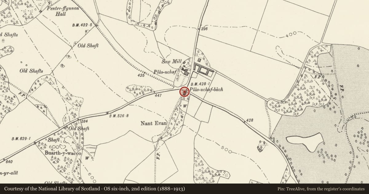
Slide toward Today to fade the historical sheet and see the modern map underneath.
David Rumsey Map Collection, Stanford LibrariesDavid Rumsey Map Collection, Stanford LibrariesDavid Rumsey Map Collection, Stanford LibrariesLlyfrgell Genedlaethol Cymru – The National Library of WalesDavid Rumsey Map Collection, Stanford Libraries
5 historical maps cover this location, the earliest the 1795 map "To Sir Watkin Williams-Wynn Bart ... the map of the six counties of North Wales is most humbly inscribed by his obedient humble servant" (Llyfrgell Genedlaethol Cymru – The National Library of Wales).
Historical maps covering this location
- 1795 · To Sir Watkin Williams-Wynn Bart ... the map of the six counties of North Wales is most… (Llyfrgell Genedlaethol Cymru – The National Library of Wales)
- 1830 · V.3:11-15:XV. Britisches Reich. A. Kon: England. b. Frstenthum Wales: Shire: 37-40 (David Rumsey Map Collection, Stanford Libraries)
- 1883 · Watershed map England, Wales 3. (David Rumsey Map Collection, Stanford Libraries)
- 1896 · 96 Liverpool (Hills) (David Rumsey Map Collection, Stanford Libraries)
- 1901 · Sheet 9 and 10. (David Rumsey Map Collection, Stanford Libraries)
Cadw's description
Location
Located on the S side of a lane running NW from Whitford village, at a triangular road junction. The lane to the N runs past Plas Uchaf Farmhouse to Tre Mostyn.
History
A house is shown in this position on a Mostyn estate map of 1742. The house was remodelled in the C19 and the roof and stacks were replaced.
Exterior
Two-window 2-storey cottage constructed of random stone with large quoins under a slate roof with raised copings and brick end stacks. Symmetrical front facing N with central doorway. C20 planked door under a cambered head of stone voussoirs, flanked by small horned 4-pane sashes (the lower glazing bars missing), under segmental heads of stone voussoirs. Identical windows aligned above to 1st floor, immediately under the eaves. Rendered gable ends. Rear wing and C20 lean-to on its E side.
Interior
No access to interior at time of inspection.
Reason for designation
Listed as a cottage with C18 origins retaining its character.
Nearby in the register
- Plas UchafDomesticunder 1 mi
- Cart-Shed at Plas UchafAgriculture and Subsistenceunder 1 mi
- Barn at Plas UchafAgriculture and Subsistenceunder 1 mi
- 1 Lloyds CrescentDomesticunder 1 mi
Other entries of the same register within about three miles of this one, by straight line.