Cof Cymru: National Historic Assets of Wales · Wales
Livestock Shelter with Crewyard at Plas-newydd
Llanfair Dyffryn Clwyd, Denbighshire, Wales
A Grade II listed building in Llanfair Dyffryn Clwyd, Denbighshire, designated on 19 May 2001.
The record
- Designation
- Listed building, Grade II
- Broad class
- Agriculture and Subsistence
- Date of designation
- 19 May 2001
- Locality
- Llanfair Dyffryn Clwyd
- Community
- Llanfair Dyffryn Clwyd
- Unitary authority
- Denbighshire
- Country
- Wales
- Coordinates
- 53.09473, -3.28855
- Cadw reference
- 25234
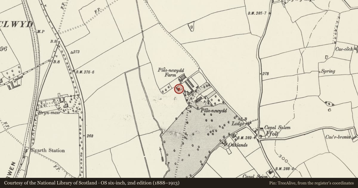
Slide toward Today to fade the historical sheet and see the modern map underneath.
David Rumsey Map Collection, Stanford LibrariesLlyfrgell Genedlaethol Cymru – The National Library of WalesDavid Rumsey Map Collection, Stanford LibrariesDavid Rumsey Map Collection, Stanford LibrariesDavid Rumsey Map Collection, Stanford Libraries
5 historical maps cover this location, the earliest the 1608 map "(13) Cambriae Typus." (David Rumsey Map Collection, Stanford Libraries).
Historical maps covering this location
- 1608 · (13) Cambriae Typus. (David Rumsey Map Collection, Stanford Libraries)
- 1795 · To Sir Watkin Williams-Wynn Bart ... the map of the six counties of North Wales is most… (Llyfrgell Genedlaethol Cymru – The National Library of Wales)
- 1830 · V.3:11-15:XV. Britisches Reich. A. Kon: England. b. Frstenthum Wales: Shire: 37-40 (David Rumsey Map Collection, Stanford Libraries)
- 1883 · Watershed map England, Wales 3. (David Rumsey Map Collection, Stanford Libraries)
- 1901 · Sheet 9 and 10. (David Rumsey Map Collection, Stanford Libraries)
Cadw's description
Location
At rear of Plas-newydd Farmyard, south of the farmhouse
History
Probably early C19
Exterior
A six-bay long range of open-fronted livestock shelters in uncoursed axe-dressed limestone, with five monolith pillar supports at front. Slate roof, tile ridge. The shed forms the west side of an approximately square walled yard which it faces, and which has a wide gateway at the south side.
Reason for designation
A well preserved livestock shelter complete with its yard, part of the well-planned Plas-newydd farmhouse and farm buildings group.
Nearby in the register
- Plas-newydd Farmhouse and attached OutbuildingsAgriculture and Subsistenceunder 1 mi
- Agricultural Range at Plas-newyddAgriculture and Subsistenceunder 1 mi
- Plas-newydd HallDomesticunder 1 mi
- Walled Garden at Plas-newyddDomesticunder 1 mi
Other entries of the same register within about three miles of this one, by straight line.