Cof Cymru: National Historic Assets of Wales · Wales
Lofted Shed and Cowhouse at Ty'n Llanfair
Llanfair Dyffryn Clwyd, Denbighshire, Wales
A Grade II listed building in Pentre Celyn, Llanfair Dyffryn Clwyd, Denbighshire, designated on 19 May 2001.
The record
- Designation
- Listed building, Grade II
- Broad class
- Agriculture and Subsistence
- Date of designation
- 19 May 2001
- Locality
- Pentre Celyn
- Community
- Llanfair Dyffryn Clwyd
- Unitary authority
- Denbighshire
- Country
- Wales
- Coordinates
- 53.05761, -3.29107
- Cadw reference
- 25223
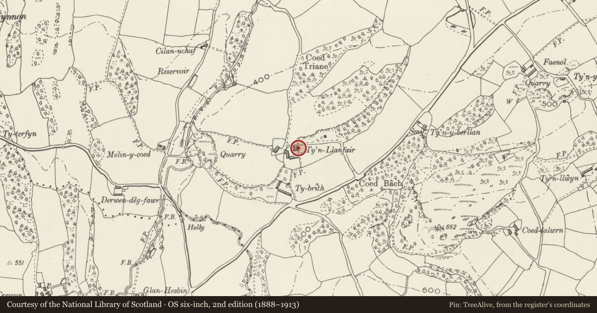
Slide toward Today to fade the historical sheet and see the modern map underneath.
David Rumsey Map Collection, Stanford LibrariesDavid Rumsey Map Collection, Stanford LibrariesLlyfrgell Genedlaethol Cymru – The National Library of WalesDavid Rumsey Map Collection, Stanford LibrariesDavid Rumsey Map Collection, Stanford Libraries
5 historical maps cover this location, the earliest the 1795 map "To Sir Watkin Williams-Wynn Bart ... the map of the six counties of North Wales is most humbly inscribed by his obedient humble servant" (Llyfrgell Genedlaethol Cymru – The National Library of Wales).
Historical maps covering this location
- 1795 · To Sir Watkin Williams-Wynn Bart ... the map of the six counties of North Wales is most… (Llyfrgell Genedlaethol Cymru – The National Library of Wales)
- 1830 · V.3:11-15:XV. Britisches Reich. A. Kon: England. b. Frstenthum Wales: Shire: 37-40 (David Rumsey Map Collection, Stanford Libraries)
- 1883 · Watershed map England, Wales 3. (David Rumsey Map Collection, Stanford Libraries)
- 1898 · 121 Wrexham (Hills) (David Rumsey Map Collection, Stanford Libraries)
- 1901 · Sheet 9 and 10. (David Rumsey Map Collection, Stanford Libraries)
Cadw's description
Location
Linked buildings at north side of Ty'n Llanfair farmyard.
History
Probably C18 or C19; the cowshed has been heightend and carries a datestone marked 1849.
Exterior
Two farm buildings in local rubble limestone with slate roofs and tile ridges, joined corner to corner as an irregular range forming the north-west side of Ty'n Llanfair farmyard. They are built into a slope of the ground at rear. Modern sheds and lean-tos within the farmyard. The shed nearer the farmhouse has a cart-opening in the south-west gable; two hatches front and rear, rear door. The other shed has a door in the south west gable, window in opposite gable, hatch in rear wall.
Interior
Each building is of two bays with vernacular queen-strut trusses. Both have lofts.
Reason for designation
Listed for group value with Ty'n Llanfair farmhouse and barns.
Nearby in the register
- Barn Range at Ty'n LlanfairAgriculture and Subsistenceunder 1 mi
- Ty'n LlanfairAgriculture and Subsistenceunder 1 mi
- Glan-hespin FarmhouseDomesticunder 1 mi
- Barn at Glan-hespinAgriculture and Subsistenceunder 1 mi
Other entries of the same register within about three miles of this one, by straight line.