Cof Cymru: National Historic Assets of Wales · Wales
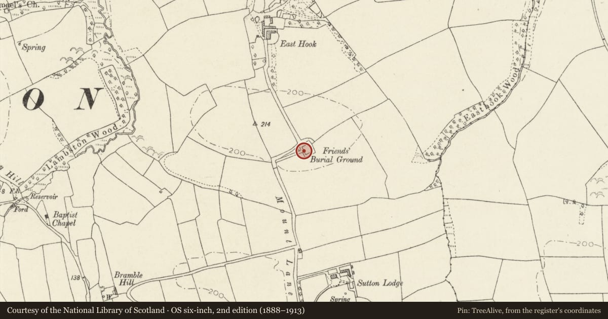
Walls of Friends Burial Ground
Camrose, Pembrokeshire, Wales
A Grade II listed building in Lambston, Haverfordwest, Camrose, Pembrokeshire, designated on 30 April 2001.
The record
- Designation
- Listed building, Grade II
- Broad class
- Religious, Ritual and Funerary
- Date of designation
- 30 April 2001
- Locality
- Lambston
- Town
- Haverfordwest
- Community
- Camrose
- Unitary authority
- Pembrokeshire
- Country
- Wales
- Coordinates
- 51.80817, -5.02336
- Cadw reference
- 25149
Slide toward Today to fade the historical sheet and see the modern map underneath.
David Rumsey Map Collection, Stanford LibrariesDavid Rumsey Map Collection, Stanford LibrariesDavid Rumsey Map Collection, Stanford LibrariesDavid Rumsey Map Collection, Stanford LibrariesDavid Rumsey Map Collection, Stanford Libraries
5 historical maps cover this location, the earliest the 1608 map "(13) Cambriae Typus." (David Rumsey Map Collection, Stanford Libraries).
Historical maps covering this location
- 1608 · (13) Cambriae Typus. (David Rumsey Map Collection, Stanford Libraries)
- 1636 · Cornubia : Devonia, Somersetus, Dorcestria, Wiltonia, Glocestria ... (David Rumsey Map Collection, Stanford Libraries)
- 1898 · 227 Milford (Outline) (David Rumsey Map Collection, Stanford Libraries)
- 1898 · 227 Milford (Hills) (David Rumsey Map Collection, Stanford Libraries)
- 1901 · Sheet 13. (David Rumsey Map Collection, Stanford Libraries)
Cadw's description
Location
Situated just S of New Park on the E side of Mount Lane some 900m NE of the centre of Sutton village.
History
Enclosing walls of Quaker Burial Ground said to have been established in 1661. The ground approached by a path along a beech avenue with earth embankments each side, and the walls surrounded by similar embankments. Within are 2 later C19 headstones, to G Phillips of Dew St (d 1869) and Sarah S Matthias (d 1861). The Quakers were established in Haverfordwest in the C17, George Fox visited in 1657 and the first Yearly Meeting for Wales was held at Redstone in 1682, but persecution led to many emigrating in the 1680s. The Quaker Meeting declined by the early C19 and the meeting house was demolished for the Shire Hall in 1835.
Exterior
Walls surrounding burial ground, on four sides, partly collapsed on S and E, entrance on E altered with concrete lintel. In the N wall an eroded C17 memorial with skull and bones and inscription: Here ly.. of Willi.. clothier..ye 8th day of Fe 1662...ye...day 1680'.
Reason for designation
Included primarily for special historic interest.
Nearby in the register
- Church of St IshmaelReligious, Ritual and Funeraryunder 1 mi
- Highmead LodgeDomesticunder 1 mi
- East DunstonDomesticunder 1 mi
- Rath 150m SE of Pelcomb FarmRath1 mi
Other entries of the same register within about three miles of this one, by straight line.