Cof Cymru: National Historic Assets of Wales · Wales
Gorse Cottage
Llanasa, Flintshire, Wales
A Grade II listed building in Trelogan, Holywell, Llanasa, Flintshire, designated on 30 April 2001.
The record
- Designation
- Listed building, Grade II
- Broad class
- Domestic
- Date of designation
- 30 April 2001
- Locality
- Trelogan
- Town
- Holywell
- Community
- Llanasa
- Unitary authority
- Flintshire
- Country
- Wales
- Coordinates
- 53.31147, -3.32539
- Cadw reference
- 25131
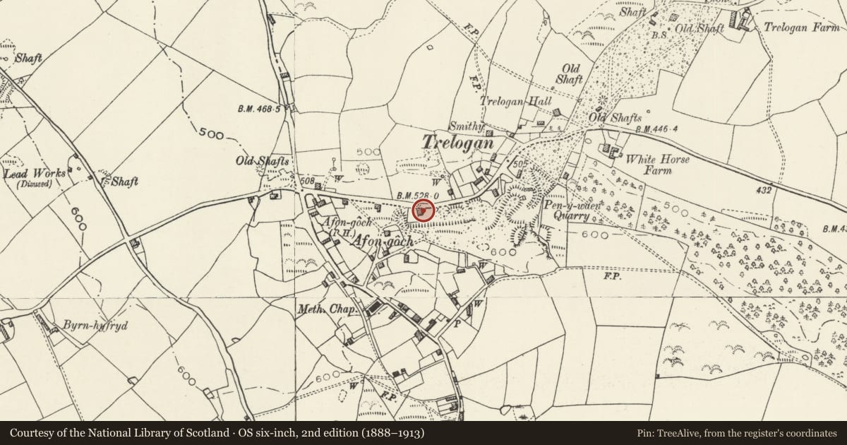
Slide toward Today to fade the historical sheet and see the modern map underneath.
David Rumsey Map Collection, Stanford LibrariesDavid Rumsey Map Collection, Stanford LibrariesDavid Rumsey Map Collection, Stanford LibrariesLlyfrgell Genedlaethol Cymru – The National Library of WalesNational Library of Scotland
5 historical maps cover this location, the earliest the 1795 map "To Sir Watkin Williams-Wynn Bart ... the map of the six counties of North Wales is most humbly inscribed by his obedient humble servant" (Llyfrgell Genedlaethol Cymru – The National Library of Wales).
Historical maps covering this location
- 1795 · To Sir Watkin Williams-Wynn Bart ... the map of the six counties of North Wales is most… (Llyfrgell Genedlaethol Cymru – The National Library of Wales)
- 1883 · Watershed map England, Wales 3. (David Rumsey Map Collection, Stanford Libraries)
- 1896 · 96 Liverpool (Hills) (David Rumsey Map Collection, Stanford Libraries)
- 1901 · Sheet 9 and 10. (David Rumsey Map Collection, Stanford Libraries)
- 1930 · OS Popular Edition 1919-1947 (National Library of Scotland)
Cadw's description
Location
On the S side of the minor road between Trelogan and Tre Mostyn, and W of a small quarry.
History
Built in the early C19 and shown as a public house on the 1839 Tithe map. The house was converted to 2 dwellings by longitudinal subdivision in the late C20. The public house served the industrial hamlet of Trelogan, where lead mining became established in the C18 and continued until the early C20.
Interior
Not inspected.
Reason for designation
Listed for retaining early C19 character, and for its association with the industrial history of Trelogan.
Nearby in the register
- Yr Hen DafarnDomesticunder 1 mi
- Moss SideDomesticunder 1 mi
- Stealey CottageDomesticunder 1 mi
- Trelogan HallDomesticunder 1 mi
Other entries of the same register within about three miles of this one, by straight line.