Cof Cymru: National Historic Assets of Wales · Wales
Cart House at Gyrn Castle
Llanasa, Flintshire, Wales
A Grade II listed building in Gyrn Castle, Llanasa, Flintshire, designated on 30 April 2001.
The record
- Designation
- Listed building, Grade II
- Broad class
- Gardens, Parks and Urban Spaces
- Date of designation
- 30 April 2001
- Locality
- Gyrn Castle
- Community
- Llanasa
- Unitary authority
- Flintshire
- Country
- Wales
- Coordinates
- 53.32354, -3.33653
- Cadw reference
- 25107
Slide toward Today to fade the historical sheet and see the modern map underneath.
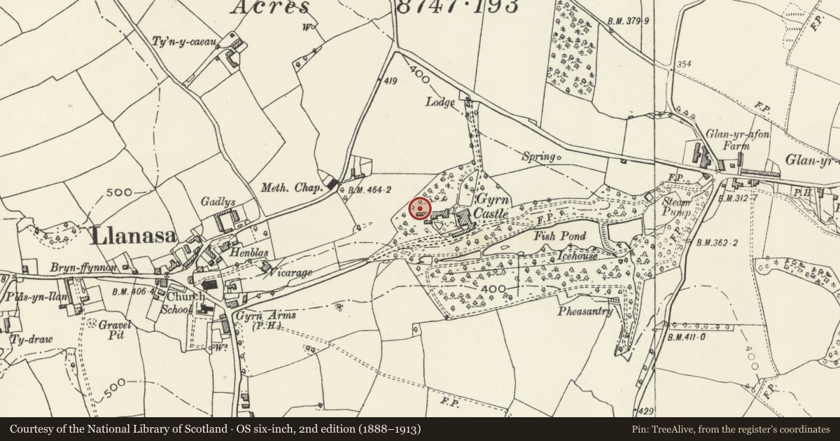
David Rumsey Map Collection, Stanford LibrariesDavid Rumsey Map Collection, Stanford LibrariesDavid Rumsey Map Collection, Stanford LibrariesNational Library of ScotlandNational Library of Scotland
5 historical maps cover this location, the earliest the 1883 map "Watershed map England, Wales 3." (David Rumsey Map Collection, Stanford Libraries).
Historical maps covering this location
- 1883 · Watershed map England, Wales 3. (David Rumsey Map Collection, Stanford Libraries)
- 1885 · OS One-Inch (Hills) 1885-1903 (National Library of Scotland)
- 1896 · 96 Liverpool (Hills) (David Rumsey Map Collection, Stanford Libraries)
- 1901 · Sheet 9 and 10. (David Rumsey Map Collection, Stanford Libraries)
- 1930 · OS Popular Edition 1919-1947 (National Library of Scotland)
Cadw's description
Location
At the NW end of the service yard at the rear of Gyrn Castle.
History
The present Gyrn Castle was built for John Douglas, a Holywell cotton manufacturer, in the period 1817-24, and was an enlargement of an earlier house. The house was subsequently bought by Sir Edward Bates, a Liverpool merchant and ship owner. The cart house was built in the third quarter of the C19 and is first shown on the 1871 Ordnance Survey. It is possibly by the Liverpool architects Culshaw & Sumners, who received other estate commissions at Gyrn.
Exterior
A cart house of coursed rubble stone, with tooled stone dressings, and slate roof. Two openings for carts have 4-centred arches, above which are shuttered loft openings beneath the eaves. The R gable end has a fixed loft light in a wood frame, below which is a corrugated iron canopy attached to a later stable range detached at right angles. The rear is continuous with a rubble stone wall and has 2 small lintelled openings.
Reason for designation
Listed as a well-preserved C19 cart shed and an integral component of the well-preserved service buildings at Gyrn Castle.
Nearby in the register
- Stable at W end of service yard at Gyrn CastleGardens, Parks and Urban Spacesunder 1 mi
- Coach house & stable block at Gyrn CastleGardens, Parks and Urban Spacesunder 1 mi
- Gateway and boundary wall to W of service yard at Gyrn CastleGardens, Parks and Urban Spacesunder 1 mi
- Gateway and wall to N side of service yard at Gyrn CastleGardens, Parks and Urban Spacesunder 1 mi
Other entries of the same register within about three miles of this one, by straight line.