Cof Cymru: National Historic Assets of Wales · Wales
Cromwell House
Chepstow, Monmouthshire, Wales
A Grade II listed building in Chepstow, Monmouthshire, designated on 14 March 1955.
The record
- Designation
- Listed building, Grade II
- Broad class
- Domestic
- Date of designation
- 14 March 1955
- Locality
- Chepstow
- Town
- Chepstow
- Community
- Chepstow
- Unitary authority
- Monmouthshire
- Country
- Wales
- Coordinates
- 51.64406, -2.67295
- Cadw reference
- 2505
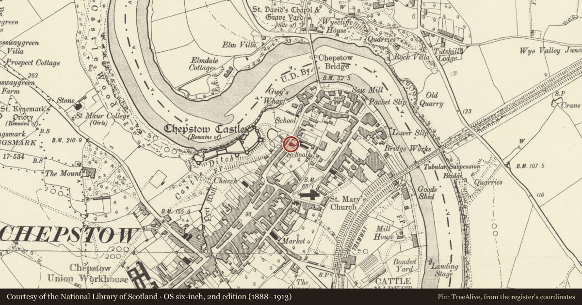
Slide toward Today to fade the historical sheet and see the modern map underneath.
David Rumsey Map Collection, Stanford LibrariesDavid Rumsey Map Collection, Stanford LibrariesDavid Rumsey Map Collection, Stanford LibrariesDavid Rumsey Map Collection, Stanford LibrariesDavid Rumsey Map Collection, Stanford Libraries
5 historical maps cover this location, the earliest the 1636 map "Cornubia : Devonia, Somersetus, Dorcestria, Wiltonia, Glocestria ..." (David Rumsey Map Collection, Stanford Libraries).
Historical maps covering this location
- 1636 · Cornubia : Devonia, Somersetus, Dorcestria, Wiltonia, Glocestria ... (David Rumsey Map Collection, Stanford Libraries)
- 1830 · V.3:11-15:XV.Britisches Reich. A. Kon: England. a. England ab sich: Shire:15-17, 33 (David Rumsey Map Collection, Stanford Libraries)
- 1895 · Sheet 11. Ordnance Survey of England and Wales. (David Rumsey Map Collection, Stanford Libraries)
- 1897 · 250 Chepstow (Outline) (David Rumsey Map Collection, Stanford Libraries)
- 1905 · 250 Chepstow (Hills) (David Rumsey Map Collection, Stanford Libraries)
Cadw's description
Location
Opposite the Three Tuns Inn, adjacent to former school.
History
Probably C16 origin with later remodelling. Name reflects claim that Oliver Cromwell slept in the house after taking Chepstow in 1648.
Exterior
Detached house, shop on ground floor. Pebbledashed and painted with pantiled roof. 3 storeys, end gable fronting road with bargeboards and applied timber-framing in gable; battered. 2-window range of cambered headed 9/6 pane sashes with thick glazing bars and exposed frames to first and ground floor; casement window to gable. Doorway at end left is square-headed with plain oak door, iron hinges and hood. Plinth, chamfered right corner. Stepped down in 2 wings to rear.
Interior
Interior retains ground floor stone Tudor fireplace with flat arch and spandrels; 2 chamfered beams parallel with frontage, flag floor. Roof with wind-braces believed to be retained.
Reason for designation
Listed as a rare early surviving house with interesting historical associations. Group value with other listed buildings in the upper part of Bridge Street.
Nearby in the register
- Three Tuns InnCommercialunder 1 mi
- Ashburne HouseDomesticunder 1 mi
- Chepstow Castle PHCommercialunder 1 mi
- Castle Terrace, numbers 33a-47 consecDomesticunder 1 mi
Other entries of the same register within about three miles of this one, by straight line.