Cof Cymru: National Historic Assets of Wales · Wales
Well-house to N of Graig House
Skenfrith, Monmouthshire, Wales
A Grade II listed building in Cross Ash, Monmouth, Skenfrith, Monmouthshire, designated on 19 March 2001.
The record
- Designation
- Listed building, Grade II
- Broad class
- Water Supply and Drainage
- Date of designation
- 19 March 2001
- Locality
- Cross Ash
- Town
- Monmouth
- Community
- Skenfrith
- Unitary authority
- Monmouthshire
- Country
- Wales
- Coordinates
- 51.87737, -2.86335
- Cadw reference
- 25020
Slide toward Today to fade the historical sheet and see the modern map underneath.
David Rumsey Map Collection, Stanford LibrariesDavid Rumsey Map Collection, Stanford LibrariesDavid Rumsey Map Collection, Stanford LibrariesDavid Rumsey Map Collection, Stanford LibrariesDavid Rumsey Map Collection, Stanford Libraries
5 historical maps cover this location, the earliest the 1636 map "Cornubia : Devonia, Somersetus, Dorcestria, Wiltonia, Glocestria ..." (David Rumsey Map Collection, Stanford Libraries).
Historical maps covering this location
- 1636 · Cornubia : Devonia, Somersetus, Dorcestria, Wiltonia, Glocestria ... (David Rumsey Map Collection, Stanford Libraries)
- 1830 · V.3:11-15:XV.Britisches Reich. A. Kon: England. a. England ab sich: Shire:15-17, 33 (David Rumsey Map Collection, Stanford Libraries)
- 1895 · Sheet 11. Ordnance Survey of England and Wales. (David Rumsey Map Collection, Stanford Libraries)
- 1896 · 233 Monmouth (Hills) (David Rumsey Map Collection, Stanford Libraries)
- 1901 · Sheet 14. (David Rumsey Map Collection, Stanford Libraries)
Cadw's description
Location
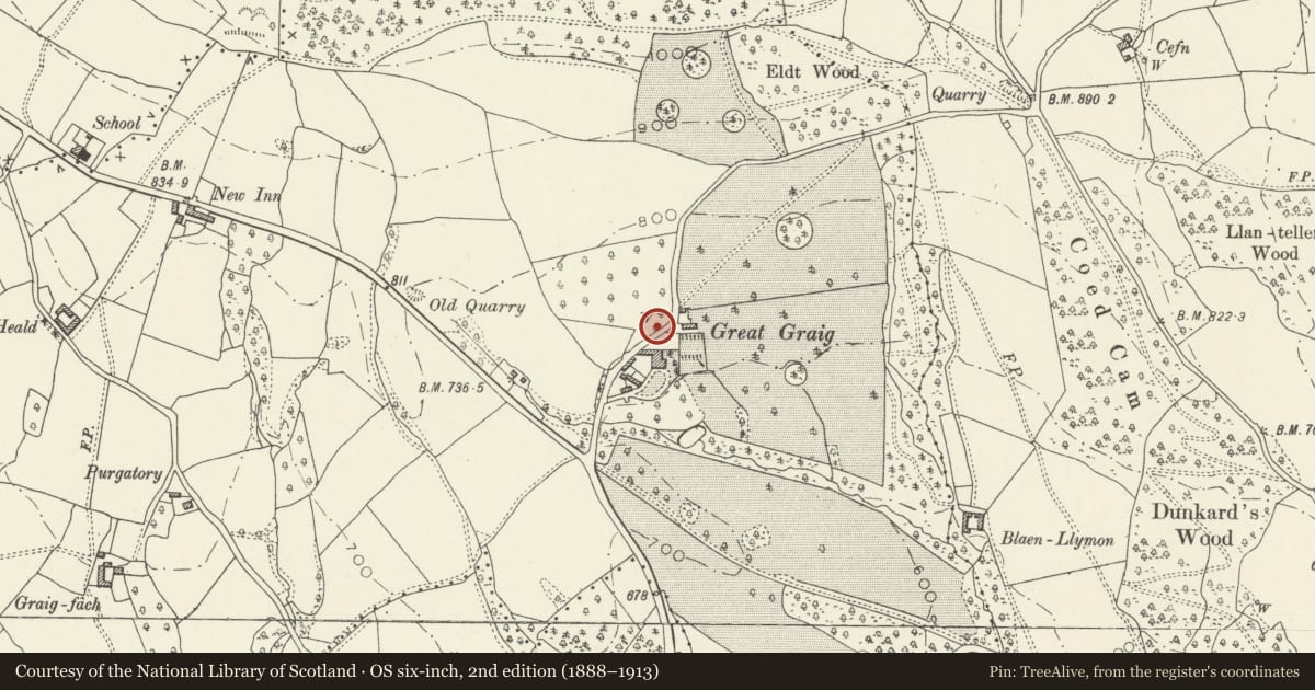
Situated on the north side of the lane passing the rear of Graig House, and approximately opposite that house.
History
Built to serve Graig House, probably in the earlier C19 when Graig House was remodelled.
Exterior
A small but visually very attractive building of red brick in Flemish bond with burnt headers, with a tall pyramidal slate roof. Approximately 2 metres square in plan and 2 metres high at the front, it is built into a 45-degree slope of higher ground to the rear, where the eaves are just above ground level, and its front wall has a vertical-rectangular window which is now boarded. The left corner is concealed by vegetation.
Interior
Not accessible.
Reason for designation
Listed as a simple example of a distinctive and unusual building type; one of a group of similar buildings in this locality, with Stone Wellhouse opposite New Inn Farm (q.v.) and Well-house on E side of lane opposite village hall (q.v.).
Nearby in the register
- Graig House (aka Great Graig) including terrace to S and EDomesticunder 1 mi
- Former coach-house and screen wall to W of Graig HouseTransportunder 1 mi
- Well-house on E side of lane, opposite village hallWater Supply and Drainageunder 1 mi
- Stone Wellhouse opposite New Inn FarmDomesticunder 1 mi
Other entries of the same register within about three miles of this one, by straight line.