Cof Cymru: National Historic Assets of Wales · Wales
Groes-wen
Llanelidan, Denbighshire, Wales
A Grade II listed building in Llanelidan, Ruthin, Denbighshire, designated on 21 March 2001.
The record
- Designation
- Listed building, Grade II
- Broad class
- Domestic
- Date of designation
- 21 March 2001
- Locality
- Llanelidan
- Town
- Ruthin
- Community
- Llanelidan
- Unitary authority
- Denbighshire
- Country
- Wales
- Coordinates
- 53.02635, -3.32474
- Cadw reference
- 24996
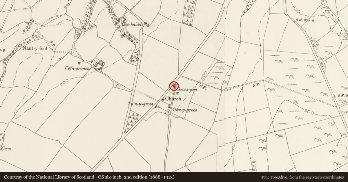
Slide toward Today to fade the historical sheet and see the modern map underneath.
David Rumsey Map Collection, Stanford LibrariesDavid Rumsey Map Collection, Stanford LibrariesLlyfrgell Genedlaethol Cymru – The National Library of WalesDavid Rumsey Map Collection, Stanford LibrariesDavid Rumsey Map Collection, Stanford Libraries
5 historical maps cover this location, the earliest the 1795 map "To Sir Watkin Williams-Wynn Bart ... the map of the six counties of North Wales is most humbly inscribed by his obedient humble servant" (Llyfrgell Genedlaethol Cymru – The National Library of Wales).
Historical maps covering this location
- 1795 · To Sir Watkin Williams-Wynn Bart ... the map of the six counties of North Wales is most… (Llyfrgell Genedlaethol Cymru – The National Library of Wales)
- 1830 · V.3:11-15:XV. Britisches Reich. A. Kon: England. b. Frstenthum Wales: Shire: 37-40 (David Rumsey Map Collection, Stanford Libraries)
- 1883 · Watershed map England, Wales 3. (David Rumsey Map Collection, Stanford Libraries)
- 1898 · 121 Wrexham (Hills) (David Rumsey Map Collection, Stanford Libraries)
- 1901 · Sheet 9 and 10. (David Rumsey Map Collection, Stanford Libraries)
Cadw's description
Location
Beside minor road 2 km south of Llanelidan church, at start of a lane branching to Ty'n-y-pant.
History
A small agricultural labourer's cottage, shown on the 1874 map, and since enlarged at rear.
Exterior
A single-storey two-unit cottage, standing in a hollow between the road and a lane, and facing north. It is rendered and whitened and has a slate roof and tile ridge. End-chimneys also rendered and whitened. Restored central heck-door. Four-pane casement windows with painted sills. Small lean-to at left, fronting the lane, with later sheds to its rear. Stone front garden wall to the lane with wooden gate.
Interior
Interior not seen.
Reason for designation
An unusual survival of a C19 single storey agricultural labourer's cottage of the smallest description, which has retained its vernacular character.
Nearby in the register
- Tom Dongen Round BarrowRound Barrowunder 1 mi
- Stable Range at Plas-yr-esgobDomesticunder 1 mi
- Lofted Cartshed Range at Plas-yr-esgobDomesticunder 1 mi
- Plas-yr-esgob (The Bishop's Manor House)Domesticunder 1 mi
Other entries of the same register within about three miles of this one, by straight line.