Cof Cymru: National Historic Assets of Wales · Wales
Carmel Baptist Chapel with Former Caretaker's House at rear
Llanelidan, Denbighshire, Wales
A Grade II listed building in Llanelidan, Ruthin, Denbighshire, designated on 21 March 2001.
The record
- Designation
- Listed building, Grade II
- Broad class
- Religious, Ritual and Funerary
- Date of designation
- 21 March 2001
- Locality
- Llanelidan
- Town
- Ruthin
- Community
- Llanelidan
- Unitary authority
- Denbighshire
- Country
- Wales
- Coordinates
- 53.04332, -3.33356
- Cadw reference
- 24994
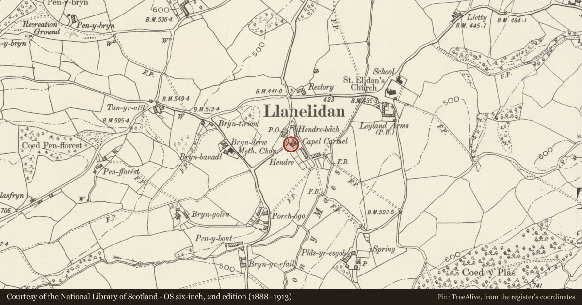
Slide toward Today to fade the historical sheet and see the modern map underneath.
David Rumsey Map Collection, Stanford LibrariesLlyfrgell Genedlaethol Cymru – The National Library of WalesDavid Rumsey Map Collection, Stanford LibrariesDavid Rumsey Map Collection, Stanford LibrariesDavid Rumsey Map Collection, Stanford Libraries
5 historical maps cover this location, the earliest the 1608 map "(13) Cambriae Typus." (David Rumsey Map Collection, Stanford Libraries).
Historical maps covering this location
- 1608 · (13) Cambriae Typus. (David Rumsey Map Collection, Stanford Libraries)
- 1795 · To Sir Watkin Williams-Wynn Bart ... the map of the six counties of North Wales is most… (Llyfrgell Genedlaethol Cymru – The National Library of Wales)
- 1830 · V.3:11-15:XV. Britisches Reich. A. Kon: England. b. Frstenthum Wales: Shire: 37-40 (David Rumsey Map Collection, Stanford Libraries)
- 1883 · Watershed map England, Wales 3. (David Rumsey Map Collection, Stanford Libraries)
- 1901 · Sheet 9 and 10. (David Rumsey Map Collection, Stanford Libraries)
Cadw's description
Location
In Llanelidan village between Hendre cottages and Hendre-bach.
History
Constructed in the mid-C19, and extended forward almost to the street line in 1906. The 1874 map shows the smaller outline of the chapel and that the cottage at the rear was not yet then connected to the chapel.
Exterior
A chapel in rough cast render with smooth render dressings; slate roof with red tile ridge; two small ventilators at ridge. The front elevation has a frame surrounding the main door and triplet windows above, consisting of rusticated pilasters joined by a stilted segmental arch. The door has rusticated jambs and a stilted segmental arch, the windows have a square head. This centre feature is flanked by an eight pane sash window with margin glazing each side, and there are four similar windows at each side elevation.
Centrally at the gable apex is a round ventilator and embossed lettering, 'Carmel Bedyddwyr 1906'
Now attached at rear, but formerly detached, is a small rendered cottage: two window and door front elevation (to south), slate roof, tile ridge, timber casements at rear.
Interior
Interior not inspected.
Reason for designation
A typical early-C20 village chapel listed for group value as unusually forming the centrepiece of an estate village.
Nearby in the register
- 6, Hendre BachDomesticunder 1 mi
- 6, Hendre CottagesDomesticunder 1 mi
- 5, Hendre BachDomesticunder 1 mi
- 5, Hendre CottagesDomesticunder 1 mi
Other entries of the same register within about three miles of this one, by straight line.