Cof Cymru: National Historic Assets of Wales · Wales
Limekiln at Trewyn Farm
Llanelidan, Denbighshire, Wales
A Grade II listed building in Rhyd-y-meudwy, Ruthin, Llanelidan, Denbighshire, designated on 21 March 2001.
The record
- Designation
- Listed building, Grade II
- Broad class
- Industrial
- Date of designation
- 21 March 2001
- Locality
- Rhyd-y-meudwy
- Town
- Ruthin
- Community
- Llanelidan
- Unitary authority
- Denbighshire
- Country
- Wales
- Coordinates
- 53.05160, -3.30475
- Cadw reference
- 24990
Slide toward Today to fade the historical sheet and see the modern map underneath.
David Rumsey Map Collection, Stanford LibrariesDavid Rumsey Map Collection, Stanford LibrariesDavid Rumsey Map Collection, Stanford LibrariesLlyfrgell Genedlaethol Cymru – The National Library of WalesDavid Rumsey Map Collection, Stanford Libraries
5 historical maps cover this location, the earliest the 1795 map "To Sir Watkin Williams-Wynn Bart ... the map of the six counties of North Wales is most humbly inscribed by his obedient humble servant" (Llyfrgell Genedlaethol Cymru – The National Library of Wales).
Historical maps covering this location
- 1795 · To Sir Watkin Williams-Wynn Bart ... the map of the six counties of North Wales is most… (Llyfrgell Genedlaethol Cymru – The National Library of Wales)
- 1883 · Watershed map England, Wales 3. (David Rumsey Map Collection, Stanford Libraries)
- 1898 · 121 Wrexham (Hills) (David Rumsey Map Collection, Stanford Libraries)
- 1898 · 121 Wrexham (Outline) (David Rumsey Map Collection, Stanford Libraries)
- 1901 · Sheet 9 and 10. (David Rumsey Map Collection, Stanford Libraries)
Cadw's description
Location
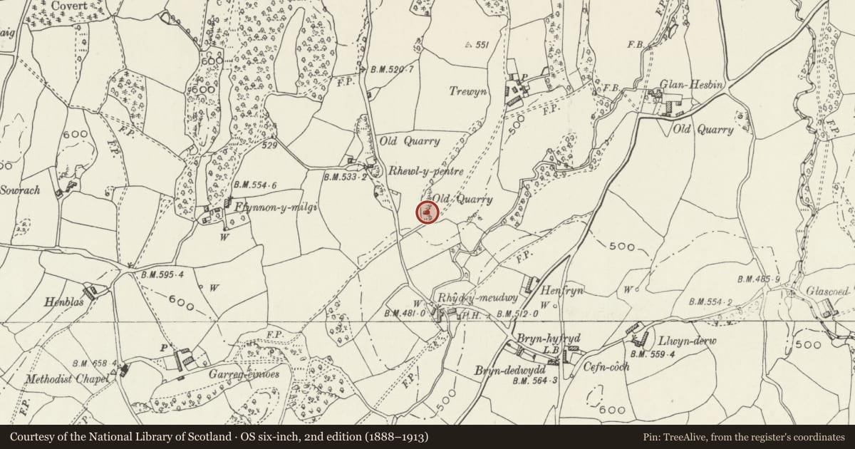
At north of main entrance to Trewyn, in small quarry.
History
A late C19 limekiln, shown on the 1874 Ordnance Survey map; probably for local farm use.
Exterior
A small limekiln in rough undressed limestone blocks, about 8m square in plan and about 5m high, near the roadside to the south of a small quarry, at the entrance to Trewyn farm. The opening at top is about 2m diameter and there is still some vitrified lining in place. The kiln is built against a quarried face and there is a ramp up to the top on the east side. Working recessed at north and south both 1½m wide and deep, with corbelled sides. Iron bar and brick lining to the working hole are visible on the south side.
Reason for designation
Well preserved example of a small agricultural limekiln.
Nearby in the register
- Cartshed at Glan-hespinAgriculture and Subsistenceunder 1 mi
- Glan-hespin FarmhouseDomesticunder 1 mi
- Barn at Glan-hespinAgriculture and Subsistenceunder 1 mi
- Rhyd-y-marchogion Farmhouse with attached cartshed range and garden wallAgriculture and Subsistenceunder 1 mi
Other entries of the same register within about three miles of this one, by straight line.