Cof Cymru: National Historic Assets of Wales · Wales
Llwynybrain Cottage
Whitland, Carmarthenshire, Wales
A Grade II listed building in Whitland, Carmarthenshire, designated on 8 March 2001.
The record
- Designation
- Listed building, Grade II
- Broad class
- Domestic
- Date of designation
- 8 March 2001
- Locality
- Whitland
- Town
- Whitland
- Community
- Whitland
- Unitary authority
- Carmarthenshire
- Country
- Wales
- Coordinates
- 51.80484, -4.61437
- Cadw reference
- 24953
Slide toward Today to fade the historical sheet and see the modern map underneath.
David Rumsey Map Collection, Stanford LibrariesDavid Rumsey Map Collection, Stanford LibrariesDavid Rumsey Map Collection, Stanford LibrariesDavid Rumsey Map Collection, Stanford LibrariesDavid Rumsey Map Collection, Stanford Libraries
5 historical maps cover this location, the earliest the 1636 map "Cornubia : Devonia, Somersetus, Dorcestria, Wiltonia, Glocestria ..." (David Rumsey Map Collection, Stanford Libraries).
Historical maps covering this location
- 1636 · Cornubia : Devonia, Somersetus, Dorcestria, Wiltonia, Glocestria ... (David Rumsey Map Collection, Stanford Libraries)
- 1830 · V.3:11-15:XV. Britisches Reich. A. Kon: England. b. Frstenthum Wales: Shire: 37-40 (David Rumsey Map Collection, Stanford Libraries)
- 1891 · Sheet 10. Ordnance Survey of England and Wales. . (David Rumsey Map Collection, Stanford Libraries)
- 1898 · 228 Haverfordwest (Hills) (David Rumsey Map Collection, Stanford Libraries)
- 1901 · Sheet 13. (David Rumsey Map Collection, Stanford Libraries)
Cadw's description
Location
Situated on E side of Llwynybrain Hill, opposite back drive and just up from main drive to Llwynybrain mansion
History
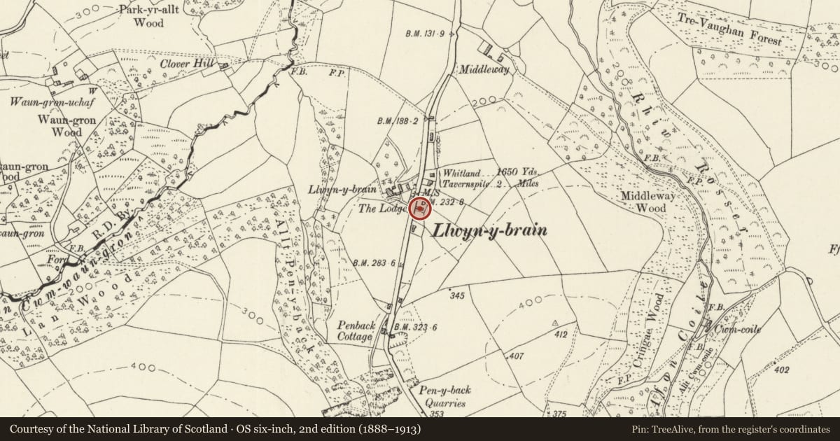
Early C19 cottage, part of the Llwynybrain estate, marked on OS as The Lodge.
Exterior
Cottage, colourwashed roughcast with corrugated iron roof and two small end-wall chimneys. One storey and loft, double fronted with two small 4-pane sashes and centre door in later lean-to porch. Outbuilding to left, lofted with tiny square light left of centre and centre door below. W end wall has window and blocked loft light above. Small single storey E end outbuilding with door to front. Rear has various lean-to additions, house rear was probably originally windowless but has rear door opposite front door.
Interior
Original plan of cross-passage with kitchen to W and parlour to E modified by removal of partitions, cutting back of kitchen fireplace and alteration of stairs (now running up behind parlour, but presumably originally either by kitchen fireplace or by ladder). Rough hewn joists throughout suggest that cottage was lofted right through from the outset. Roof now of C20 pine probably replaces thatch.
Reason for designation
Included as a rare survivor of a lofted single storey cottage, a building type once typical of the region but now scarce.
Nearby in the register
- Trevaughan Bridge.Transportunder 1 mi
- Cyffig ChurchReligious, Ritual and Funeraryunder 1 mi
- BrunantDomestic1 mi
- Roman Road 250m NE of Pwll-y-HwyaidRoad1 mi
Other entries of the same register within about three miles of this one, by straight line.