Cof Cymru: National Historic Assets of Wales · Wales
Lychgate and Stile to the Churchyard of Penallt Old Church (St Mary's)
Trellech United, Monmouthshire, Wales
A Grade II listed building in Penallt, Monmouth, Trellech United, Monmouthshire, designated on 28 February 2001.
The record
- Designation
- Listed building, Grade II
- Broad class
- Miscellaneous
- Date of designation
- 28 February 2001
- Locality
- Penallt
- Town
- Monmouth
- Community
- Trellech United
- Unitary authority
- Monmouthshire
- Country
- Wales
- Coordinates
- 51.79279, -2.69440
- Cadw reference
- 24928
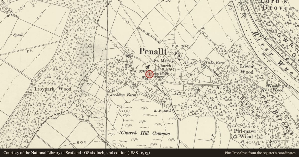
Slide toward Today to fade the historical sheet and see the modern map underneath.
David Rumsey Map Collection, Stanford LibrariesDavid Rumsey Map Collection, Stanford LibrariesDavid Rumsey Map Collection, Stanford LibrariesDavid Rumsey Map Collection, Stanford LibrariesDavid Rumsey Map Collection, Stanford Libraries
5 historical maps cover this location, the earliest the 1636 map "Cornubia : Devonia, Somersetus, Dorcestria, Wiltonia, Glocestria ..." (David Rumsey Map Collection, Stanford Libraries).
Historical maps covering this location
- 1636 · Cornubia : Devonia, Somersetus, Dorcestria, Wiltonia, Glocestria ... (David Rumsey Map Collection, Stanford Libraries)
- 1830 · V.3:11-15:XV.Britisches Reich. A. Kon: England. a. England ab sich: Shire:15-17, 33 (David Rumsey Map Collection, Stanford Libraries)
- 1895 · Sheet 11. Ordnance Survey of England and Wales. (David Rumsey Map Collection, Stanford Libraries)
- 1896 · 233 Monmouth (Hills) (David Rumsey Map Collection, Stanford Libraries)
- 1901 · Sheet 14. (David Rumsey Map Collection, Stanford Libraries)
Cadw's description
Location
At the entrance to the Churchyard of Penallt Old Church on the south side.
History
A lychgate and stile dating probably from early in the C20, but apparently not a memorial to WWI.
Exterior
These structures are built of sandstone conglomerate with a stone slate roof and oak gates to the lychgate. A simple design with bold rubble walls supporting a gabled oak roof. Plain double gates. To the right of the lychgate (from outside the churchyard) is a stile approached up three steps. The stile itself is a slab set upright between the gable wall of the gate and the rubble churchyard wall.
Reason for designation
Included for group value with the Old Church.
Nearby in the register
- Cross in the Churchyard of Penallt Old Church (St Mary's)Religious, Ritual and Funeraryunder 1 mi
- Penallt Churchyard CrossCrossunder 1 mi
- Tomb of Thomas Prichard in Churchyard of Penallt Old Church (St Mary's)Religious, Ritual and Funeraryunder 1 mi
- Telephone Call-box (01600 713619)Communicationsunder 1 mi
Other entries of the same register within about three miles of this one, by straight line.