Cof Cymru: National Historic Assets of Wales · Wales
Group of four Chest Tombs in Churchyard to the south west of Church of St Oudoceus
Wye Valley, Monmouthshire, Wales
A Grade II listed building in Llandogo, Monmouth, Wye Valley, Monmouthshire, designated on 28 February 2001.
The record
- Designation
- Listed building, Grade II
- Broad class
- Religious, Ritual and Funerary
- Date of designation
- 28 February 2001
- Locality
- Llandogo
- Town
- Monmouth
- Community
- Wye Valley
- Unitary authority
- Monmouthshire
- Country
- Wales
- Coordinates
- 51.73324, -2.68697
- Cadw reference
- 24918
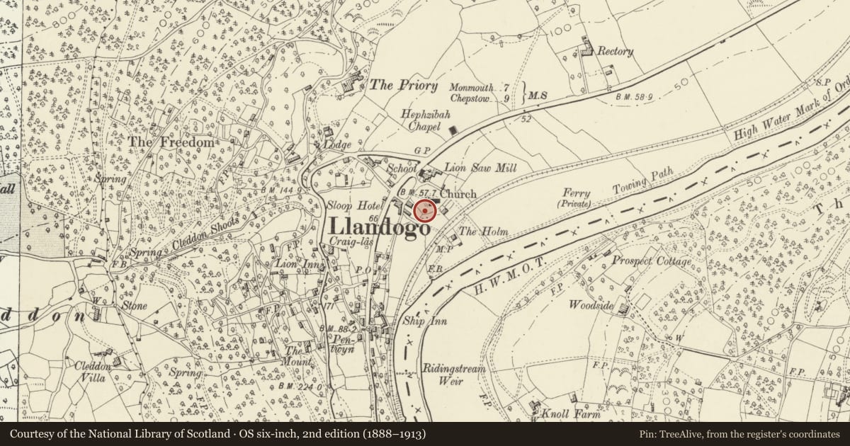
Slide toward Today to fade the historical sheet and see the modern map underneath.
David Rumsey Map Collection, Stanford LibrariesDavid Rumsey Map Collection, Stanford LibrariesDavid Rumsey Map Collection, Stanford LibrariesDavid Rumsey Map Collection, Stanford LibrariesDavid Rumsey Map Collection, Stanford Libraries
5 historical maps cover this location, the earliest the 1636 map "Cornubia : Devonia, Somersetus, Dorcestria, Wiltonia, Glocestria ..." (David Rumsey Map Collection, Stanford Libraries).
Historical maps covering this location
- 1636 · Cornubia : Devonia, Somersetus, Dorcestria, Wiltonia, Glocestria ... (David Rumsey Map Collection, Stanford Libraries)
- 1637 · The fourth table of England. Cornub. Devonia, Somerset etc. (David Rumsey Map Collection, Stanford Libraries)
- 1830 · V.3:11-15:XV.Britisches Reich. A. Kon: England. a. England ab sich: Shire:15-17, 33 (David Rumsey Map Collection, Stanford Libraries)
- 1895 · Sheet 11. Ordnance Survey of England and Wales. (David Rumsey Map Collection, Stanford Libraries)
- 1896 · 233 Monmouth (Hills) (David Rumsey Map Collection, Stanford Libraries)
Cadw's description
Location
About 20m to the south west of the Church of St Oudoceus.
History
Group of four chest tombs dating from the mid and late C18. The dates of death recorded are 1736, 1748, 1749 and 1789.
Exterior
Four sandstone chest tombs with scrolled corner balusters and slab tops with cyma recta mouldings. They are inscribed severally :-
Benjamin Lewis, died 1748
Anne, wife of George Lewis, died 1749
Barbara Griffiths, died 1736
Mary, wife of Jon Holt, died 1789
Reason for designation
Included as a particularly good and well preserved group of C18 chest tombs having strong group value with the Church of St Oudoceus, the other churchyard monuments and the churchyard wall.
Nearby in the register
- Group of three Chest Tombs to the south of the Church of St OudoceusReligious, Ritual and Funeraryunder 1 mi
- Church of St OudoceusReligious, Ritual and Funeraryunder 1 mi
- Wall of Churchyard of Church of St OudoceusReligious, Ritual and Funeraryunder 1 mi
- Priory LodgeDomesticunder 1 mi
Other entries of the same register within about three miles of this one, by straight line.