Cof Cymru: National Historic Assets of Wales · Wales
Lychgate of the Church of St Nicholas
Trellech United, Monmouthshire, Wales
A Grade II listed building in Trellech, Monmouth, Trellech United, Monmouthshire, designated on 28 February 2001.
The record
- Designation
- Listed building, Grade II
- Broad class
- Commemorative
- Date of designation
- 28 February 2001
- Locality
- Trellech
- Town
- Monmouth
- Community
- Trellech United
- Unitary authority
- Monmouthshire
- Country
- Wales
- Coordinates
- 51.74549, -2.72494
- Cadw reference
- 24915
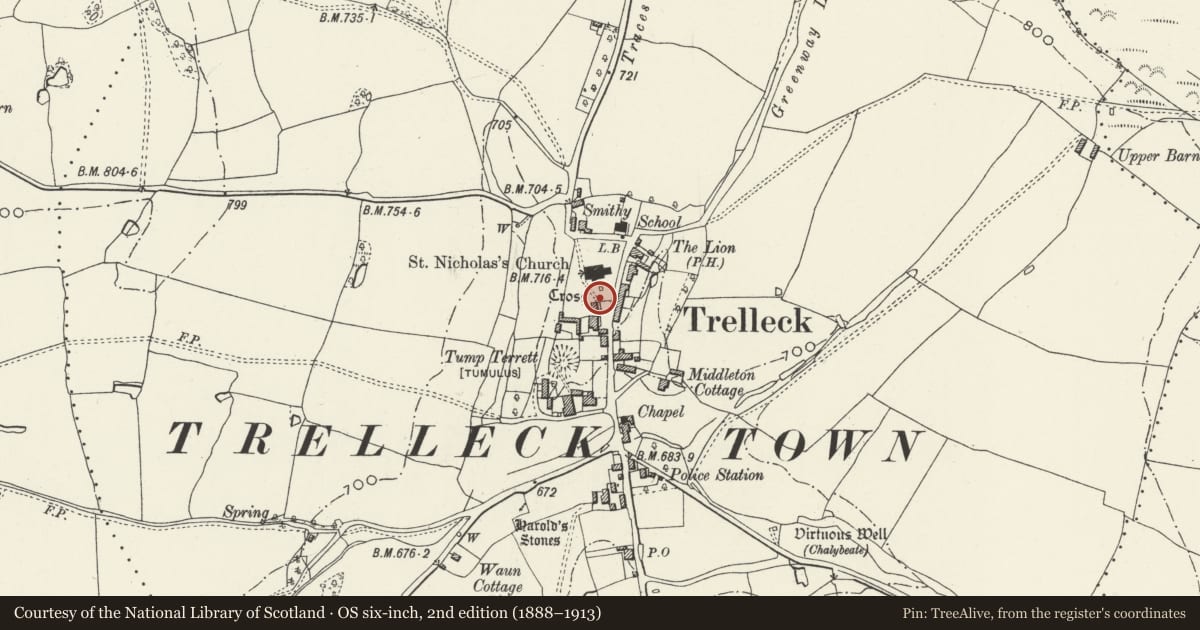
Slide toward Today to fade the historical sheet and see the modern map underneath.
David Rumsey Map Collection, Stanford LibrariesDavid Rumsey Map Collection, Stanford LibrariesDavid Rumsey Map Collection, Stanford LibrariesDavid Rumsey Map Collection, Stanford LibrariesDavid Rumsey Map Collection, Stanford Libraries
5 historical maps cover this location, the earliest the 1636 map "Cornubia : Devonia, Somersetus, Dorcestria, Wiltonia, Glocestria ..." (David Rumsey Map Collection, Stanford Libraries).
Historical maps covering this location
- 1636 · Cornubia : Devonia, Somersetus, Dorcestria, Wiltonia, Glocestria ... (David Rumsey Map Collection, Stanford Libraries)
- 1830 · V.3:11-15:XV.Britisches Reich. A. Kon: England. a. England ab sich: Shire:15-17, 33 (David Rumsey Map Collection, Stanford Libraries)
- 1895 · Sheet 11. Ordnance Survey of England and Wales. (David Rumsey Map Collection, Stanford Libraries)
- 1896 · 233 Monmouth (Hills) (David Rumsey Map Collection, Stanford Libraries)
- 1913 · Sheet 102. Newport. (David Rumsey Map Collection, Stanford Libraries)
Cadw's description
Location
In the centre of Trellech village immediately to the south of the Church of St Nicholas.
History
A lychgate of c1908, see below and The Croft.
Exterior
It is constructed of coursed red sandstone blocks with a stone slate roof and oak gates. The square pyramidal roof is supported on one side by a stone wall and on the other directly off the wall of The Croft on a corbel bracket. Double oak gates with swept tops. The apex of the roof is crowned by a cross.
Reason for designation
Included for group value with the other listed buildings in the centre of Trellech village.
Nearby in the register
- The CroftEducationunder 1 mi
- Trellech Churchyard CrossCrossunder 1 mi
- Cross in the churchyard of the Church of St NicholasReligious, Ritual and Funeraryunder 1 mi
- Double Barn to the north of Trellech FarmhouseAgriculture and Subsistenceunder 1 mi
Other entries of the same register within about three miles of this one, by straight line.