Cof Cymru: National Historic Assets of Wales · Wales
167 Broadway
Pontypridd, Rhondda Cynon Taff, Wales
A Grade II listed building in Treforest, Pontypridd, Rhondda Cynon Taff, designated on 4 February 1980.
The record
- Designation
- Listed building, Grade II
- Broad class
- Domestic
- Date of designation
- 4 February 1980
- Locality
- Treforest
- Town
- Pontypridd
- Community
- Pontypridd
- Unitary authority
- Rhondda Cynon Taff
- Country
- Wales
- Coordinates
- 51.59680, -3.32965
- Cadw reference
- 24904
Slide toward Today to fade the historical sheet and see the modern map underneath.
David Rumsey Map Collection, Stanford LibrariesNational Library of ScotlandDavid Rumsey Map Collection, Stanford LibrariesDavid Rumsey Map Collection, Stanford LibrariesDavid Rumsey Map Collection, Stanford Libraries
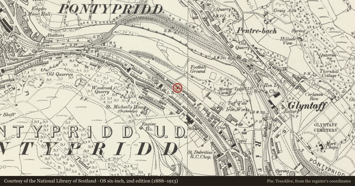
5 historical maps cover this location, the earliest the 1636 map "Cornubia : Devonia, Somersetus, Dorcestria, Wiltonia, Glocestria ..." (David Rumsey Map Collection, Stanford Libraries).
Historical maps covering this location
- 1636 · Cornubia : Devonia, Somersetus, Dorcestria, Wiltonia, Glocestria ... (David Rumsey Map Collection, Stanford Libraries)
- 1637 · The fourth table of England. Cornub. Devonia, Somerset etc. (David Rumsey Map Collection, Stanford Libraries)
- 1865 · England and Wales. England No. 6. (David Rumsey Map Collection, Stanford Libraries)
- 1895 · Sheet 11. Ordnance Survey of England and Wales. (David Rumsey Map Collection, Stanford Libraries)
- 1963 · Map No. 14 - Local Government Commission for Wales : [Definitive maps showing proposed… (National Library of Scotland)
Cadw's description
History
A piecemeal development begun in the second quarter of the C19, probably mainly corresponding with the enlargement of the Treforest Tinplate Works in 1835. Nos 161-72 are shown on the 1846 Tithe map, while Nos 172-6 were probably added soon after. Most of the houses are double-fronted with 2 ground floor rooms and winding stone stairs, a type characteristic of early C19 S Wales. At the S end, No 161 is larger and may have been a foreman's house, while Nos 162-4 were probably originally pairs of back-to-back single-unit dwellings, a type not well documented in S Wales.
Exterior
A double-fronted house rendered and painted white. The roof is replaced with synthetic slates.
Reason for designation
Nos 161-176 are listed, notwithstanding modern alteration, for their social-historical interest as the most instructive surviving example of early-mid C19 workmen's houses in Pontypridd.
Nearby in the register
- 166 BroadwayDomesticunder 1 mi
- 168 BroadwayDomesticunder 1 mi
- 165 BroadwayDomesticunder 1 mi
- 169 BroadwayDomesticunder 1 mi
Other entries of the same register within about three miles of this one, by straight line.