Cof Cymru: National Historic Assets of Wales · Wales
Neuadd-Fadog
Duhonw, Powys, Wales
A Grade II listed building in Maesmynis, Builth Wells, Duhonw, Powys, designated on 22 February 2001.
The record
- Designation
- Listed building, Grade II
- Broad class
- Domestic
- Date of designation
- 22 February 2001
- Locality
- Maesmynis
- Town
- Builth Wells
- Community
- Duhonw
- Unitary authority
- Powys
- Country
- Wales
- Coordinates
- 52.10373, -3.43691
- Cadw reference
- 24820
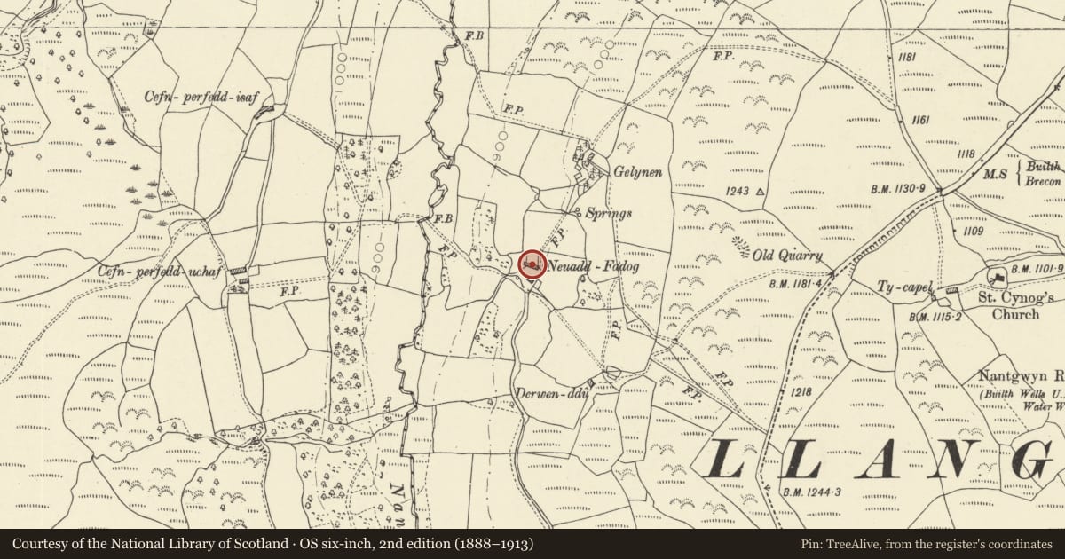
Slide toward Today to fade the historical sheet and see the modern map underneath.
David Rumsey Map Collection, Stanford LibrariesDavid Rumsey Map Collection, Stanford LibrariesDavid Rumsey Map Collection, Stanford LibrariesDavid Rumsey Map Collection, Stanford LibrariesDavid Rumsey Map Collection, Stanford Libraries
5 historical maps cover this location, the earliest the 1608 map "(13) Cambriae Typus." (David Rumsey Map Collection, Stanford Libraries).
Historical maps covering this location
- 1608 · (13) Cambriae Typus. (David Rumsey Map Collection, Stanford Libraries)
- 1637 · Particular description of Wales. Cambria seu Wallia (David Rumsey Map Collection, Stanford Libraries)
- 1830 · V.3:11-15:XV. Britisches Reich. A. Kon: England. b. Frstenthum Wales: Shire: 37-40 (David Rumsey Map Collection, Stanford Libraries)
- 1899 · 196 Builth (Hills) (David Rumsey Map Collection, Stanford Libraries)
- 1901 · Sheet 14. (David Rumsey Map Collection, Stanford Libraries)
Cadw's description
Location
Situated in a remote location at the end of a long track W off the B4520 some 3km SW of Llanddewi'r Cwm.
History
Farmhouse late C17 to early C18, with attached small outbuilding.
Exterior
Farmhouse, whitewashed rubble stone with late C20 slate roof and rubble stone right end stack. Low two-storey, two-window front offset to left, with two tiny loft casement pair windows under eaves, over ground floor C20 casement pair and half-glazed C20 door both with timber lintels. Timber lintel built into wall to right of door. Rubble stone rear with two C20 casement pair windows and curve of a bread oven to left.
Attached small single storey outbuilding to right with corrugated asbestos sheet roof, door to extreme left, casement pair window to right under long timber lintel of former door. Added lean-to on end wall.
Interior
Interior not accessible at time of survey.
Reason for designation
Included as a smaller vernacular farmhouse of well-preserved regional character.
Nearby in the register
- Cefn Corast Deserted Rural SettlementRectangular hut1 mi
- Cwmhindda Deserted Rural SettlementPlatform house2 mi
- Church of St DavidReligious, Ritual and Funerary2 mi
- Banc y Celyn Stone CircleStone Circle2 mi
Other entries of the same register within about three miles of this one, by straight line.