Cof Cymru: National Historic Assets of Wales · Wales
Penrallt
Llanfaethlu, Isle of Anglesey, Wales
A Grade II listed building in Porth Trefadog, Holyhead, Llanfaethlu, Isle of Anglesey, designated on 16 February 2001.
The record
- Designation
- Listed building, Grade II
- Broad class
- Domestic
- Date of designation
- 16 February 2001
- Locality
- Porth Trefadog
- Town
- Holyhead
- Community
- Llanfaethlu
- Unitary authority
- Isle of Anglesey
- Country
- Wales
- Coordinates
- 53.34348, -4.55639
- Cadw reference
- 24795
Slide toward Today to fade the historical sheet and see the modern map underneath.
David Rumsey Map Collection, Stanford LibrariesDavid Rumsey Map Collection, Stanford LibrariesDavid Rumsey Map Collection, Stanford LibrariesDavid Rumsey Map Collection, Stanford LibrariesDavid Rumsey Map Collection, Stanford Libraries
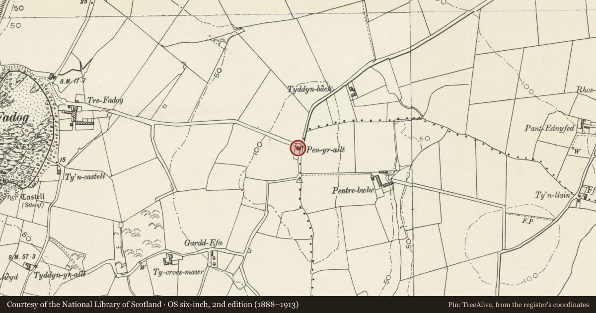
5 historical maps cover this location, the earliest the 1799 map "Ireland." (David Rumsey Map Collection, Stanford Libraries).
Historical maps covering this location
- 1799 · Ireland. (David Rumsey Map Collection, Stanford Libraries)
- 1883 · Watershed map England, Wales 3. (David Rumsey Map Collection, Stanford Libraries)
- 1899 · 93 Holyhead (Hills) (David Rumsey Map Collection, Stanford Libraries)
- 1901 · Sheet 9 and 10. (David Rumsey Map Collection, Stanford Libraries)
- 1919 · Sheet 41. Anglesey. (David Rumsey Map Collection, Stanford Libraries)
Cadw's description
Location
Located at the SW corner of the road junction leading the Trefadog at Porth Trefadog.
History
Probably C18 cottage, formerly the gatehouse to small estate around Trefadog. Added wing to rear built in mid C20. Part of the C19 estate of Lord Stanley of Alderley.
Exterior
Single storey cottage range, with single storey wing added at right angles to rear to form a T-shaped plan. Built of local stone, limewashed. Roof of small old slates, grouted. Gable stacks to cottage and former cowhouse; that to L (E) end of cottage a large stack, probably to inglenook. Original cottage to R (W) end; 2-windows offset to R and with doorway between; lean to addition at W end. Former cowhouse to left, now with door to R (W) and window to L. Windows are 4-pane hooded sashes, with slate sills; modern boarded doors.
Reason for designation
Included as an especially well-preserved single storey vernacular cottage range, a type once common on the island.
Nearby in the register
- TrefadogDomesticunder 1 mi
- Castell Near Tre-FadogPromontory Fort- coastalunder 1 mi
- Uwch y donDomesticunder 1 mi
- Gateposts and wall, Uwch y donDomesticunder 1 mi
Other entries of the same register within about three miles of this one, by straight line.