Cof Cymru: National Historic Assets of Wales · Wales
Dam and Retaining Walls of Pond by the Walled Garden at Piercefield Park
Chepstow, Monmouthshire, Wales
A Grade II listed building in Piercefield Park, Chepstow, Monmouthshire, designated on 14 February 2001.
The record
- Designation
- Listed building, Grade II
- Broad class
- Domestic
- Date of designation
- 14 February 2001
- Locality
- Piercefield Park
- Town
- Chepstow
- Community
- Chepstow
- Unitary authority
- Monmouthshire
- Country
- Wales
- Coordinates
- 51.65892, -2.68479
- Cadw reference
- 24776
Slide toward Today to fade the historical sheet and see the modern map underneath.
David Rumsey Map Collection, Stanford LibrariesDavid Rumsey Map Collection, Stanford LibrariesDavid Rumsey Map Collection, Stanford LibrariesDavid Rumsey Map Collection, Stanford LibrariesDavid Rumsey Map Collection, Stanford Libraries
5 historical maps cover this location, the earliest the 1636 map "Cornubia : Devonia, Somersetus, Dorcestria, Wiltonia, Glocestria ..." (David Rumsey Map Collection, Stanford Libraries).
Historical maps covering this location
- 1636 · Cornubia : Devonia, Somersetus, Dorcestria, Wiltonia, Glocestria ... (David Rumsey Map Collection, Stanford Libraries)
- 1830 · V.3:11-15:XV.Britisches Reich. A. Kon: England. a. England ab sich: Shire:15-17, 33 (David Rumsey Map Collection, Stanford Libraries)
- 1895 · Sheet 11. Ordnance Survey of England and Wales. (David Rumsey Map Collection, Stanford Libraries)
- 1897 · 250 Chepstow (Outline) (David Rumsey Map Collection, Stanford Libraries)
- 1905 · 250 Chepstow (Hills) (David Rumsey Map Collection, Stanford Libraries)
Cadw's description
Location
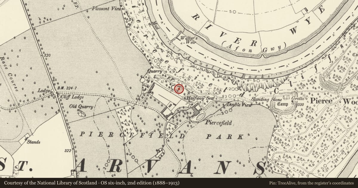
About 50m north of the east end of the Walled Garden at Piercefield House.
History
This pool probably formed a part of the gardens laid out round Piercefield House by Valentine Morris in the 1760s and 1770s. The elaborate dam was necessary to retain water at the top of the cliff and the niche appears to have held the housing for a ram pump. For further history of the Piercefield estate see Piercefield House.
Exterior
Stone rubble wall forming a bowed dam with a central arched niche which must originally have contained a fountain. Below this is another niche which still has an iron water pipe in it. This dam is about 3m in height in the centre and is about 30m in length. It forms one side of a rectangular pool which is enclosed by low rubble walls on the other sides. The pool is now almost dry.
Reason for designation
Included as a late C18 garden water feature which, despite damage, remains a significant component of the nationally important historic landscape of Piercefield Park.
Nearby in the register
- Barn and attached Byre near Piercefield StablesAgriculture and Subsistenceunder 1 mi
- Walls of Walled Garden and attached Bothies and Cottage at Piercefield ParkDomesticunder 1 mi
- Ruins of Piercefield House (Central Block)Domesticunder 1 mi
- Ruins of Piercefield House, Right Hand or East PavilionDomesticunder 1 mi
Other entries of the same register within about three miles of this one, by straight line.