Cof Cymru: National Historic Assets of Wales · Wales
Broom House
Raglan, Monmouthshire, Wales
A Grade II listed building in Raglan, Monmouthshire, designated on 31 January 2001.
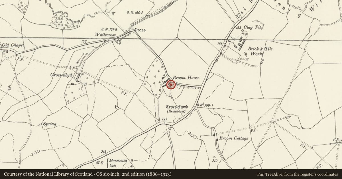
The record
- Designation
- Listed building, Grade II
- Broad class
- Domestic
- Date of designation
- 31 January 2001
- Locality
- Raglan
- Town
- Raglan
- Community
- Raglan
- Unitary authority
- Monmouthshire
- Country
- Wales
- Coordinates
- 51.75596, -2.86685
- Cadw reference
- 24734
Slide toward Today to fade the historical sheet and see the modern map underneath.
David Rumsey Map Collection, Stanford LibrariesDavid Rumsey Map Collection, Stanford LibrariesDavid Rumsey Map Collection, Stanford LibrariesDavid Rumsey Map Collection, Stanford LibrariesDavid Rumsey Map Collection, Stanford Libraries
5 historical maps cover this location, the earliest the 1636 map "Cornubia : Devonia, Somersetus, Dorcestria, Wiltonia, Glocestria ..." (David Rumsey Map Collection, Stanford Libraries).
Historical maps covering this location
- 1636 · Cornubia : Devonia, Somersetus, Dorcestria, Wiltonia, Glocestria ... (David Rumsey Map Collection, Stanford Libraries)
- 1830 · V.3:11-15:XV.Britisches Reich. A. Kon: England. a. England ab sich: Shire:15-17, 33 (David Rumsey Map Collection, Stanford Libraries)
- 1895 · Sheet 11. Ordnance Survey of England and Wales. (David Rumsey Map Collection, Stanford Libraries)
- 1896 · 233 Monmouth (Hills) (David Rumsey Map Collection, Stanford Libraries)
- 1913 · Sheet 102. Newport. (David Rumsey Map Collection, Stanford Libraries)
Cadw's description
Location
Situated about 1. 5 km SW of Raglan, on S side of Broom Lane which runs W from the Usk road. Broom House is about 150m down Broom Lane and within its own walled grounds.
History
Earlier C19 gentry house. The parish church contains a memorial window of 1868 to Philip Morgan of The Broom. Sir Joseph Bradney records a house called Blue Broom in the parish, occupied in 1822 by Edmund Bowyer, and in 1911 owned by Richard Pryce "who has much improved it".
Exterior
Country house, painted stucco with slate hipped roofs, bracketed flat eaves and rendered end stacks. Two storeys, three-window range with outer tripartite sashes, 3-9-3-pane above, 4-12-4-pane below, and centre 9-pane sash over added large stone porch. Half-glazed door within. Rear is slightly outshut with arched small-paned centre stair-window over door, and attractive large curved square 20-pane sash each floor at left angle, with roof curved to match, below level of main eaves. Added dormer above.
To right, large rear wing with hipped roof and 2-window end wall. Return wall to rear court has 9-pane first floor sash and 2 12-pane ground floor sashes.
Interior
Interior not available for inspection at the time of resurvey (December 1999)
Reason for designation
Listed as a fine early C19 house set in its own grounds.
Nearby in the register
- Cross at Croes LwydReligious, Ritual and Funeraryunder 1 mi
- Cross on Croes Lwyd FarmCrossunder 1 mi
- Agricultural labourers cottageDomesticunder 1 mi
- TwynysheriffDomesticunder 1 mi
Other entries of the same register within about three miles of this one, by straight line.