Cof Cymru: National Historic Assets of Wales · Wales
Toll Gate House
Abergavenny, Monmouthshire, Wales
A Grade II listed building in Abergavenny, Monmouthshire, designated on 1 November 1974.
The record
- Designation
- Listed building, Grade II
- Broad class
- Transport
- Date of designation
- 1 November 1974
- Locality
- Abergavenny
- Town
- Abergavenny
- Community
- Abergavenny
- Unitary authority
- Monmouthshire
- Country
- Wales
- Coordinates
- 51.82679, -3.02166
- Cadw reference
- 2468
Slide toward Today to fade the historical sheet and see the modern map underneath.
David Rumsey Map Collection, Stanford LibrariesDavid Rumsey Map Collection, Stanford LibrariesDavid Rumsey Map Collection, Stanford LibrariesDavid Rumsey Map Collection, Stanford LibrariesDavid Rumsey Map Collection, Stanford Libraries
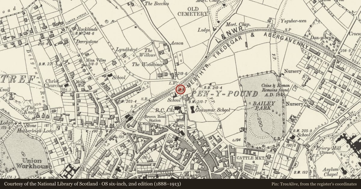
5 historical maps cover this location, the earliest the 1636 map "Cornubia : Devonia, Somersetus, Dorcestria, Wiltonia, Glocestria ..." (David Rumsey Map Collection, Stanford Libraries).
Historical maps covering this location
- 1636 · Cornubia : Devonia, Somersetus, Dorcestria, Wiltonia, Glocestria ... (David Rumsey Map Collection, Stanford Libraries)
- 1856 · 42. Brecon. (David Rumsey Map Collection, Stanford Libraries)
- 1898 · 232 Abergavenny (Hills) (David Rumsey Map Collection, Stanford Libraries)
- 1898 · 232 Abergavenny (Outline) (David Rumsey Map Collection, Stanford Libraries)
- 1901 · Sheet 14. (David Rumsey Map Collection, Stanford Libraries)
Cadw's description
Location
On the west side of Pen-y-pound and one of the varied group of historic buildings on the main north-eastern access to Abergavenny.
History
Early C19 toll house, probably 1831. The building was in a ruinous condition in 1974 and has been fully restored since.
Exterior
Rendered and painted with natural slate roof and red brick stack. In the form of a stretched hexagon with a central rear wing. One storey, five sided to road. Gothic style pointed windows and door. Windows facing in all directions to street, all with interlacing glazing bars intact. Hipped roofs with central chimney stack.
Rear elevation not inspected.
Interior
Interior not inspected at resurvey.
Reason for designation
Included for its special interest as a well preserved early C19 turnpike toll-house, which has retained its character and has group value with the other listed buildings in Pen-y-pound.
Nearby in the register
- Entrance Gates of No. 11No class recordedunder 1 mi
- Ty'r Morwydd (St Michael's Convent), residence onlyReligious, Ritual and Funeraryunder 1 mi
- The Cloisters, including garden wall and door to roadDomesticunder 1 mi
- Catholic Church of Our Lady and St Michael, including attached PresbyteryReligious, Ritual and Funeraryunder 1 mi
Other entries of the same register within about three miles of this one, by straight line.