Cof Cymru: National Historic Assets of Wales · Wales
Pig Sty and Store Block at Ty'n-y-Ddol
Llandderfel, Gwynedd, Wales
A Grade II listed building in Llandderfel, Gwynedd, designated on 31 January 2001.
The record
- Designation
- Listed building, Grade II
- Broad class
- Agriculture and Subsistence
- Date of designation
- 31 January 2001
- Locality
- Llandderfel
- Community
- Llandderfel
- Unitary authority
- Gwynedd
- Country
- Wales
- Coordinates
- 52.91483, -3.52064
- Cadw reference
- 24644
Slide toward Today to fade the historical sheet and see the modern map underneath.
David Rumsey Map Collection, Stanford LibrariesDavid Rumsey Map Collection, Stanford LibrariesLlyfrgell Genedlaethol Cymru – The National Library of WalesDavid Rumsey Map Collection, Stanford LibrariesDavid Rumsey Map Collection, Stanford Libraries
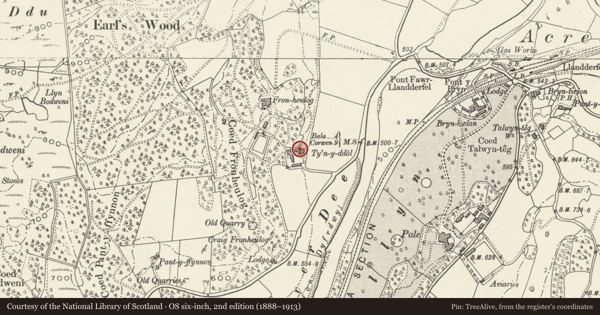
5 historical maps cover this location, the earliest the 1795 map "To Sir Watkin Williams-Wynn Bart ... the map of the six counties of North Wales is most humbly inscribed by his obedient humble servant" (Llyfrgell Genedlaethol Cymru – The National Library of Wales).
Historical maps covering this location
- 1795 · To Sir Watkin Williams-Wynn Bart ... the map of the six counties of North Wales is most… (Llyfrgell Genedlaethol Cymru – The National Library of Wales)
- 1830 · V.3:11-15:XV. Britisches Reich. A. Kon: England. b. Frstenthum Wales: Shire: 37-40 (David Rumsey Map Collection, Stanford Libraries)
- 1883 · Watershed map England, Wales 3. (David Rumsey Map Collection, Stanford Libraries)
- 1899 · 136 Bala (Hills) (David Rumsey Map Collection, Stanford Libraries)
- 1901 · Sheet 9 and 10. (David Rumsey Map Collection, Stanford Libraries)
Cadw's description
Location
Located immediately S of the house.
History
Pig sty and store block built c1815 by John Davies, Calvinistic Methodistic leader, as part of a home farm complex to serve his nearby house of Fronheulog.
Exterior
L-shaped pigsty and store, with incorporated Ty Bach to the N; single storey. Of rubble construction with slated roof. The building consists of a central rectangular block with catslide projections to the R on each of the N and S sides, that to the N forming the Ty Bach and that to the S the pig sty. The latter has enclosing rubble pen walls to the front with 2 pens and plain entrances; incorporated feeding shoot to the L pen. The Ty Bach has a boarded entrance to the E; further entrance to the W gable end, with modern boarded door and boarded infill to the L; exposed timber lintel.
Reason for designation
Listed as an early C19 pig sty and store retaining good original character as part of this interesting group.
Group value with other listed items at Ty'n-y-Ddol.
Nearby in the register
- Ty'n-y-DdolDomesticunder 1 mi
- Barn Range at Ty'n-y-DdolAgriculture and Subsistenceunder 1 mi
- Carthouse and Stable Range at Ty'n-y-DdolAgriculture and Subsistenceunder 1 mi
- Fron HeulogDomesticunder 1 mi
Other entries of the same register within about three miles of this one, by straight line.