Cof Cymru: National Historic Assets of Wales · Wales
Bwthyn
Llandderfel, Gwynedd, Wales
A Grade II listed building in Rhiwlas, Bala, Llandderfel, Gwynedd, designated on 31 January 2001.
The record
- Designation
- Listed building, Grade II
- Broad class
- Domestic
- Date of designation
- 31 January 2001
- Locality
- Rhiwlas
- Town
- Bala
- Community
- Llandderfel
- Unitary authority
- Gwynedd
- Country
- Wales
- Coordinates
- 52.92187, -3.59989
- Cadw reference
- 24624
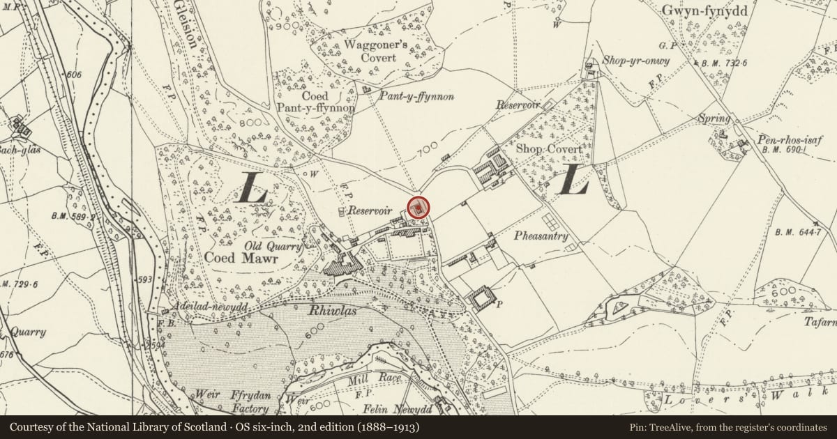
Slide toward Today to fade the historical sheet and see the modern map underneath.
David Rumsey Map Collection, Stanford LibrariesDavid Rumsey Map Collection, Stanford LibrariesLlyfrgell Genedlaethol Cymru – The National Library of WalesDavid Rumsey Map Collection, Stanford LibrariesDavid Rumsey Map Collection, Stanford Libraries
5 historical maps cover this location, the earliest the 1795 map "To Sir Watkin Williams-Wynn Bart ... the map of the six counties of North Wales is most humbly inscribed by his obedient humble servant" (Llyfrgell Genedlaethol Cymru – The National Library of Wales).
Historical maps covering this location
- 1795 · To Sir Watkin Williams-Wynn Bart ... the map of the six counties of North Wales is most… (Llyfrgell Genedlaethol Cymru – The National Library of Wales)
- 1830 · V.3:11-15:XV. Britisches Reich. A. Kon: England. b. Frstenthum Wales: Shire: 37-40 (David Rumsey Map Collection, Stanford Libraries)
- 1883 · Watershed map England, Wales 3. (David Rumsey Map Collection, Stanford Libraries)
- 1898 · 120 Corwen (Hills) (David Rumsey Map Collection, Stanford Libraries)
- 1901 · Sheet 9 and 10. (David Rumsey Map Collection, Stanford Libraries)
Cadw's description
Location
Set back slightly from the road behind a narrow fenced forecourt; one of a terrace of two.
History
Built c1870 by R J Ll Price, Esq., of Rhiwlas Hall to provide accommodation for senior estate workers and their families. The bricks used in the construction were possibly burned on the estate.
Interior
Interior not inspected at the time of survey.
Reason for designation
Listed as part of a mid-Victorian terrace of reflected estate cottages retaining good, unaltered external character in a prominent road-side location; a good example of later C19 estate building on this important estate.
Nearby in the register
- Garden CottageDomesticunder 1 mi
- Game Larder at RhiwlasAgriculture and Subsistenceunder 1 mi
- Quadrangular Stable Complex at Rhiwlas, including Y Stablau and Stablau IsaAgriculture and Subsistenceunder 1 mi
- Ice House at RhiwlasAgriculture and Subsistenceunder 1 mi
Other entries of the same register within about three miles of this one, by straight line.