Cof Cymru: National Historic Assets of Wales · Wales
Former Chapel and Manse at Cefn-ddwysarn
Llandderfel, Gwynedd, Wales
A Grade II listed building in Cefn-ddwysarn, Bala, Llandderfel, Gwynedd, designated on 31 January 2001.
The record
- Designation
- Listed building, Grade II
- Broad class
- Religious, Ritual and Funerary
- Date of designation
- 31 January 2001
- Locality
- Cefn-ddwysarn
- Town
- Bala
- Community
- Llandderfel
- Unitary authority
- Gwynedd
- Country
- Wales
- Coordinates
- 52.93360, -3.54080
- Cadw reference
- 24614
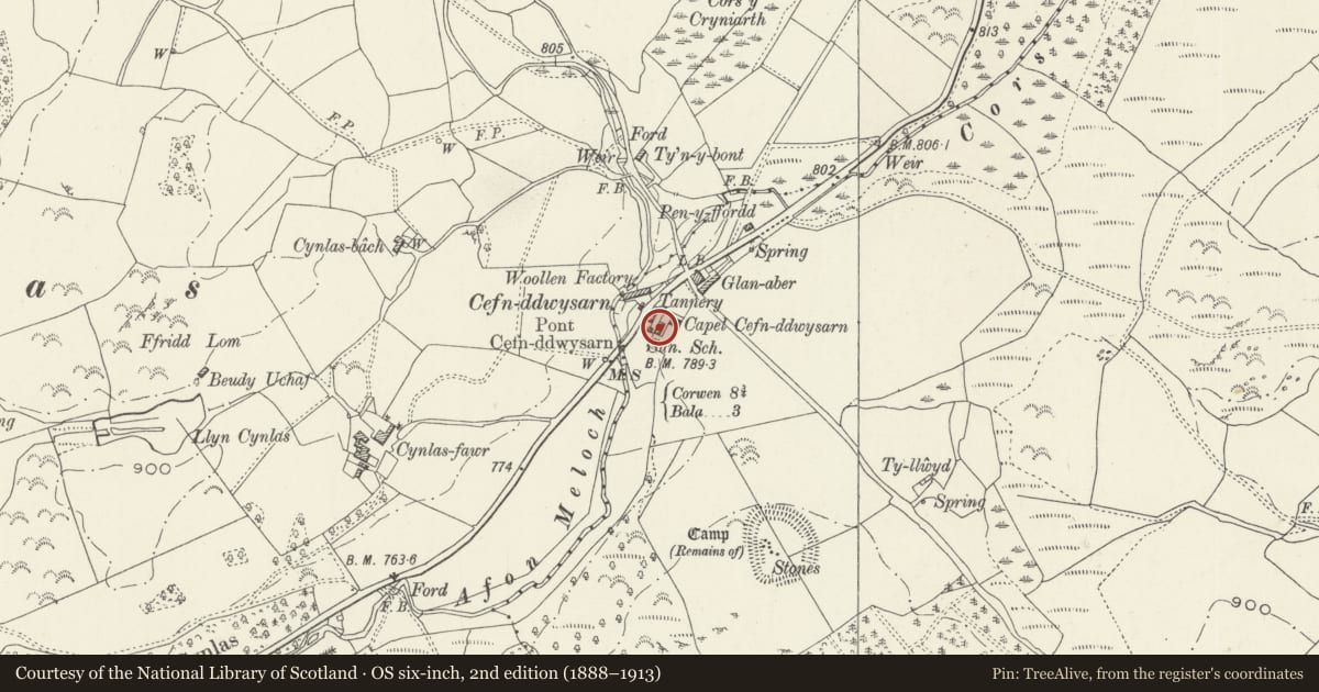
Slide toward Today to fade the historical sheet and see the modern map underneath.
David Rumsey Map Collection, Stanford LibrariesDavid Rumsey Map Collection, Stanford LibrariesLlyfrgell Genedlaethol Cymru – The National Library of WalesDavid Rumsey Map Collection, Stanford LibrariesDavid Rumsey Map Collection, Stanford Libraries
5 historical maps cover this location, the earliest the 1795 map "To Sir Watkin Williams-Wynn Bart ... the map of the six counties of North Wales is most humbly inscribed by his obedient humble servant" (Llyfrgell Genedlaethol Cymru – The National Library of Wales).
Historical maps covering this location
- 1795 · To Sir Watkin Williams-Wynn Bart ... the map of the six counties of North Wales is most… (Llyfrgell Genedlaethol Cymru – The National Library of Wales)
- 1830 · V.3:11-15:XV. Britisches Reich. A. Kon: England. b. Frstenthum Wales: Shire: 37-40 (David Rumsey Map Collection, Stanford Libraries)
- 1883 · Watershed map England, Wales 3. (David Rumsey Map Collection, Stanford Libraries)
- 1898 · 120 Corwen (Hills) (David Rumsey Map Collection, Stanford Libraries)
- 1901 · Sheet 9 and 10. (David Rumsey Map Collection, Stanford Libraries)
Cadw's description
Location
Se back slightly from the main road to the SE.
History
Second-quarter or mid C19 chapel and manse group.
Exterior
Chapel and manse in line, of slatestone rubble construction with rendered NW (rear) elevation and SW gable; continuous slate roof with skylights to the manse section, one to the front and 2 to the rear. Later C19 red brick end chimneys to the manse, with simple cornicing. The chapel has a central entrance with recessed boarded and framed door. Flanking this are 12-pane unhorned sash windows with projecting slate sills and plain rendered architraves. The manse section has similar, though smaller paired entrances to the centre, with windows to the ground and first floor at R and L. That to the ground-floor L is a small-paned sash, as before, whilst the remainder are later 4-pane sashes; those to the upper floor break the eaves and are contained within gabled dormers with plain bargeboards. The rear elevation has the same window arrangement as the facade, though reversed. A small additional plain-glazed light appears to the L of the 12-pane sash in the manse section.
Interior
The interior was not inspected at the time of survey.
Reason for designation
Listed as a mid C19 vernacular chapel and manse group of simple functional design, retaining good original external character.
Nearby in the register
- Ty GroesDomesticunder 1 mi
- Cefn Ddwysarn CampEnclosureunder 1 mi
- Agricultural Range at Cynlas FawrAgriculture and Subsistenceunder 1 mi
- Cowhouse at Cynlas FawrAgriculture and Subsistenceunder 1 mi
Other entries of the same register within about three miles of this one, by straight line.