Cof Cymru: National Historic Assets of Wales · Wales
Royal British Legion
Abergavenny, Monmouthshire, Wales
A Grade II listed building in Abergavenny, Monmouthshire, designated on 1 November 1974.
The record
- Designation
- Listed building, Grade II
- Broad class
- Domestic
- Date of designation
- 1 November 1974
- Locality
- Abergavenny
- Town
- Abergavenny
- Community
- Abergavenny
- Unitary authority
- Monmouthshire
- Country
- Wales
- Coordinates
- 51.82228, -3.01952
- Cadw reference
- 2461
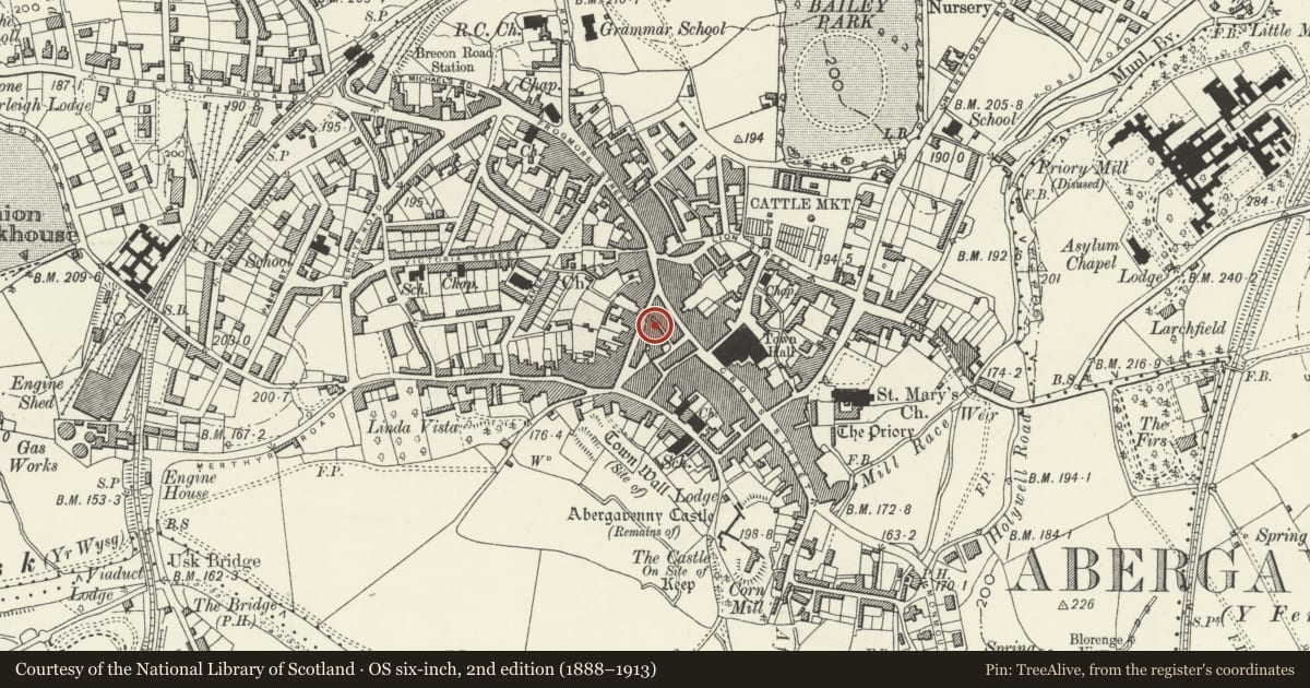
Slide toward Today to fade the historical sheet and see the modern map underneath.
David Rumsey Map Collection, Stanford LibrariesDavid Rumsey Map Collection, Stanford LibrariesDavid Rumsey Map Collection, Stanford LibrariesDavid Rumsey Map Collection, Stanford LibrariesDavid Rumsey Map Collection, Stanford Libraries
5 historical maps cover this location, the earliest the 1636 map "Cornubia : Devonia, Somersetus, Dorcestria, Wiltonia, Glocestria ..." (David Rumsey Map Collection, Stanford Libraries).
Historical maps covering this location
- 1636 · Cornubia : Devonia, Somersetus, Dorcestria, Wiltonia, Glocestria ... (David Rumsey Map Collection, Stanford Libraries)
- 1856 · 42. Brecon. (David Rumsey Map Collection, Stanford Libraries)
- 1898 · 232 Abergavenny (Hills) (David Rumsey Map Collection, Stanford Libraries)
- 1898 · 232 Abergavenny (Outline) (David Rumsey Map Collection, Stanford Libraries)
- 1901 · Sheet 14. (David Rumsey Map Collection, Stanford Libraries)
Cadw's description
Location
N part of a group of historic buildings between St John's Lane and St John's Square in the centre of Abergavenny.
History
Formed from a pair of probably late C18 or early C19 houses which were amalgamated into a club premises in 1920. It is reputed to be partly C17 in origin behind the changes of c1795. It was for some time the Dragon's Head PH which closed in 1857. The building was altered again in the 1960s.
Exterior
Rear elevation not inspected.
Interior
The interior has been greatly altered on the ground floor in its C20 conversion to club premises. C20 staircase and the upper floors have been converted to flats. It has also been run-together with No. 12 adjoining.
Reason for designation
Included for its special interest as a probably late C18 or early C19 house which, despite alteration, has good character and is a part of the most complete street of historic architecture in Abergavenny.
Nearby in the register
- Royal British LegionRecreationalunder 1 mi
- 11 Nevill StreetDomesticunder 1 mi
- The Trading PostDomesticunder 1 mi
- 13 Nevill StreetDomesticunder 1 mi
Other entries of the same register within about three miles of this one, by straight line.