Cof Cymru: National Historic Assets of Wales · Wales
Former Carthouse adjacent to the Outbuilding to the rear of Derfel Gadarn
Llandderfel, Gwynedd, Wales
A Grade II listed building in Llandderfel, Gwynedd, designated on 31 January 2001.
The record
- Designation
- Listed building, Grade II
- Broad class
- Agriculture and Subsistence
- Date of designation
- 31 January 2001
- Locality
- Llandderfel
- Community
- Llandderfel
- Unitary authority
- Gwynedd
- Country
- Wales
- Coordinates
- 52.92123, -3.51497
- Cadw reference
- 24592
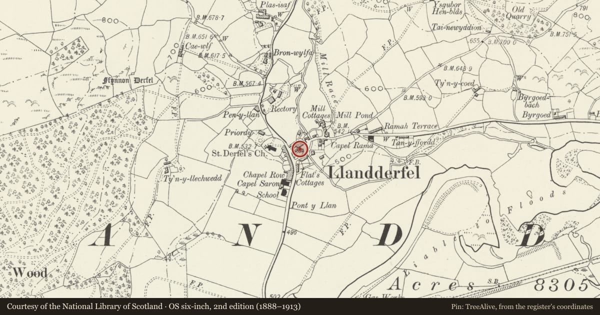
Slide toward Today to fade the historical sheet and see the modern map underneath.
David Rumsey Map Collection, Stanford LibrariesDavid Rumsey Map Collection, Stanford LibrariesLlyfrgell Genedlaethol Cymru – The National Library of WalesDavid Rumsey Map Collection, Stanford LibrariesDavid Rumsey Map Collection, Stanford Libraries
5 historical maps cover this location, the earliest the 1795 map "To Sir Watkin Williams-Wynn Bart ... the map of the six counties of North Wales is most humbly inscribed by his obedient humble servant" (Llyfrgell Genedlaethol Cymru – The National Library of Wales).
Historical maps covering this location
- 1795 · To Sir Watkin Williams-Wynn Bart ... the map of the six counties of North Wales is most… (Llyfrgell Genedlaethol Cymru – The National Library of Wales)
- 1830 · V.3:11-15:XV. Britisches Reich. A. Kon: England. b. Frstenthum Wales: Shire: 37-40 (David Rumsey Map Collection, Stanford Libraries)
- 1883 · Watershed map England, Wales 3. (David Rumsey Map Collection, Stanford Libraries)
- 1898 · 120 Corwen (Hills) (David Rumsey Map Collection, Stanford Libraries)
- 1901 · Sheet 9 and 10. (David Rumsey Map Collection, Stanford Libraries)
Cadw's description
Location
Located in a lane between Church Street and Trafalgar Street, adjacent to the Outbuilding to the Rear of Derfel Gadarn.
History
Carthouse block, probably early C19. This relates to the former Cross Keys Inn, the stable block to which it adjoins.
Exterior
Small rectangular coachhouse block of local rubble construction; steeply-pitched roof of corrugated asbestos, with slate bargeboards. Wide entrance to the lane-facing (NW) gable, with boarded doors and expressed wooden bressummer.
Interior
The interior was not inspected at the time of survey.
Reason for designation
Listed as an early C19 carthouse, part of the former Cross Keys Inn complex; part of a group of service buildings associated with the inn.
Group value with other listed items in the village centre.
Nearby in the register
- Former School Hall including adjoining Garden Wall to SWEducationunder 1 mi
- Outbuilding to the rear of Derfel GadarnAgriculture and Subsistenceunder 1 mi
- Cross KeysDomesticunder 1 mi
- Telephone Call-boxCommunicationsunder 1 mi
Other entries of the same register within about three miles of this one, by straight line.