Cof Cymru: National Historic Assets of Wales · Wales
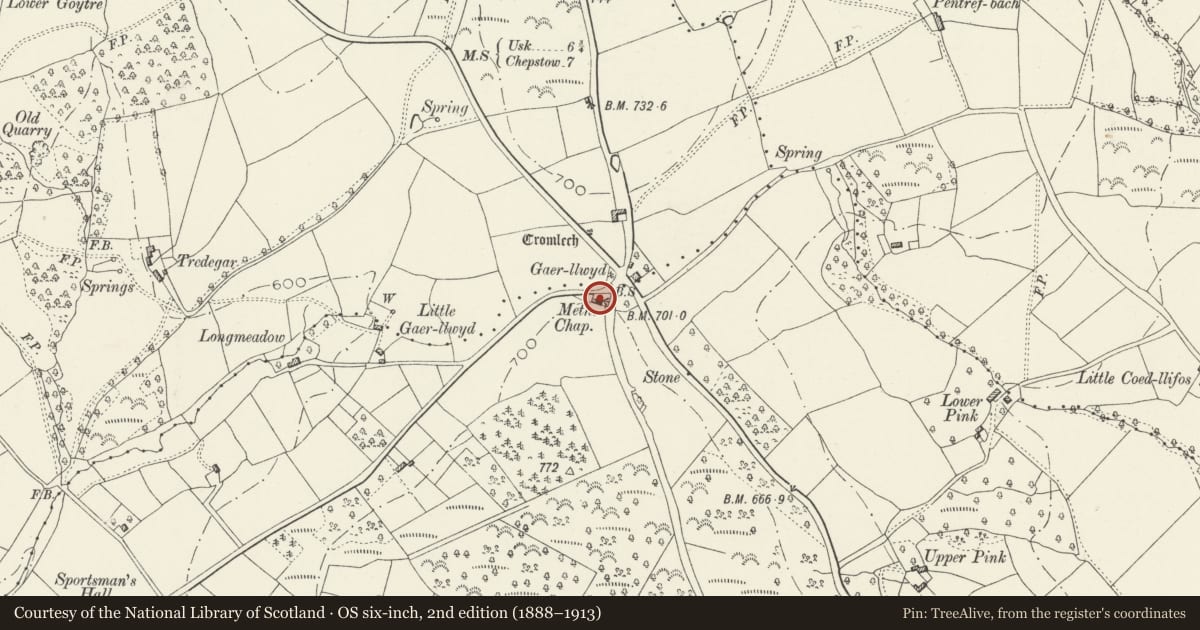
Gaerllwyd Baptist Church
Shirenewton, Monmouthshire, Wales
A Grade II listed building in Gaerllwyd, Chepstow, Shirenewton, Monmouthshire, designated on 30 January 2001.
The record
- Designation
- Listed building, Grade II
- Broad class
- Religious, Ritual and Funerary
- Date of designation
- 30 January 2001
- Locality
- Gaerllwyd
- Town
- Chepstow
- Community
- Shirenewton
- Unitary authority
- Monmouthshire
- Country
- Wales
- Coordinates
- 51.66579, -2.79988
- Cadw reference
- 24577
Slide toward Today to fade the historical sheet and see the modern map underneath.
David Rumsey Map Collection, Stanford LibrariesDavid Rumsey Map Collection, Stanford LibrariesDavid Rumsey Map Collection, Stanford LibrariesDavid Rumsey Map Collection, Stanford LibrariesDavid Rumsey Map Collection, Stanford Libraries
5 historical maps cover this location, the earliest the 1636 map "Cornubia : Devonia, Somersetus, Dorcestria, Wiltonia, Glocestria ..." (David Rumsey Map Collection, Stanford Libraries).
Historical maps covering this location
- 1636 · Cornubia : Devonia, Somersetus, Dorcestria, Wiltonia, Glocestria ... (David Rumsey Map Collection, Stanford Libraries)
- 1895 · Sheet 11. Ordnance Survey of England and Wales. (David Rumsey Map Collection, Stanford Libraries)
- 1897 · 250 Chepstow (Outline) (David Rumsey Map Collection, Stanford Libraries)
- 1905 · 250 Chepstow (Hills) (David Rumsey Map Collection, Stanford Libraries)
- 1913 · Sheet 102. Newport. (David Rumsey Map Collection, Stanford Libraries)
Cadw's description
Location
About 3km north west of Shirenewton at the junction of the village road with the B4235.
History
A non-conformist chapel which opened in 1842 as Welsh Calvinistic Methodist and was known as Mount Zion. It was later transferred to the Presbyterians and finally to the Baptists.
Exterior
This is a very small rectangular chapel built of roughcast rubble stone with a Welsh slate roof. The entrance is in the half hipped gable end. This has only a plank door in an added gabled porch. The side elevation to the left is blind. The elevation to the right has two sash windows with 8 over 8 panes and obscured glass. The rear is attached to the old manse cottage which has been altered and modernised.
Interior
Not seen at resurvey.
Reason for designation
Included as a rural non-conformist chapel of the most simple design which dates from 1842.
Nearby in the register
- Telephone Call Box at Crossroads adjacent to Boundary Wall of Gaerllwyd Baptist ChapelCommunicationsunder 1 mi
- Gaer-Llwyd Burial ChamberChambered Tombunder 1 mi
- Church of St PeterReligious, Ritual and Funeraryunder 1 mi
- MilestoneTransportunder 1 mi
Other entries of the same register within about three miles of this one, by straight line.