Cof Cymru: National Historic Assets of Wales · Wales
19 Nevill Street
Abergavenny, Monmouthshire, Wales
A Grade II listed building in Abergavenny, Monmouthshire, designated on 1 November 1974.
The record
- Designation
- Listed building, Grade II
- Broad class
- Domestic
- Date of designation
- 1 November 1974
- Locality
- Abergavenny
- Town
- Abergavenny
- Community
- Abergavenny
- Unitary authority
- Monmouthshire
- Country
- Wales
- Coordinates
- 51.82207, -3.01995
- Cadw reference
- 2455
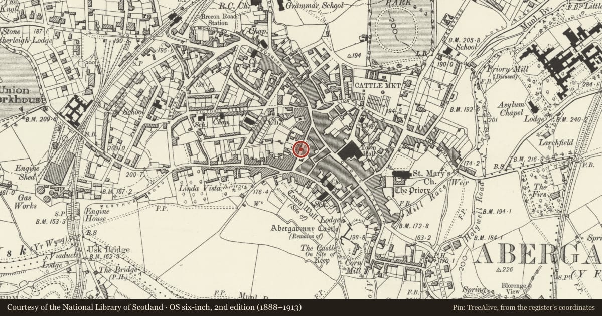
Slide toward Today to fade the historical sheet and see the modern map underneath.
David Rumsey Map Collection, Stanford LibrariesDavid Rumsey Map Collection, Stanford LibrariesDavid Rumsey Map Collection, Stanford LibrariesDavid Rumsey Map Collection, Stanford LibrariesDavid Rumsey Map Collection, Stanford Libraries
5 historical maps cover this location, the earliest the 1636 map "Cornubia : Devonia, Somersetus, Dorcestria, Wiltonia, Glocestria ..." (David Rumsey Map Collection, Stanford Libraries).
Historical maps covering this location
- 1636 · Cornubia : Devonia, Somersetus, Dorcestria, Wiltonia, Glocestria ... (David Rumsey Map Collection, Stanford Libraries)
- 1856 · 42. Brecon. (David Rumsey Map Collection, Stanford Libraries)
- 1898 · 232 Abergavenny (Hills) (David Rumsey Map Collection, Stanford Libraries)
- 1898 · 232 Abergavenny (Outline) (David Rumsey Map Collection, Stanford Libraries)
- 1901 · Sheet 14. (David Rumsey Map Collection, Stanford Libraries)
Cadw's description
Location
Midway down the continuous row of historic buildings running S from the High Street in the centre of Abergavenny.
History
Mainly early C19 in appearance, but this is the result of a heightening and re-fronting of a probably originally late C16 house. The shopfront recorded in the previous list description has gone, but it may have been recorded mistakenly. This house was completely gutted in 1984-5 and only the walling survives, the rear wall is said to possibly be pre-C18, but the rear elevation was not seen at resurvey.
Exterior
Stucco fronted and painted with a natural slate roof. Double depth central entry plan. Three storeys, two windows. The ground floor has a 6-panel door with 3-pane transom light, open pediment on console brackets. One window to left and two to right. The upper windows are above the first and third ones. Windows are all replacement joinery, 6 over 6 pane sashes, 3 over 6 on the second floor. Plain roof of moderate pitch, gable stacks.
Rear elevation not inspected.
Interior
The interior was wholly rebuilt in 1984-5.
Reason for designation
Included for its special interest as a mainly early C19 house retaining good character, which is a part of the most complete street of historic architecture in Abergavenny.
Nearby in the register
- 17 Nevill StreetDomesticunder 1 mi
- 21 Nevill StreetDomesticunder 1 mi
- Claremont HouseDomesticunder 1 mi
- 16 Nevill StreetCommercialunder 1 mi
Other entries of the same register within about three miles of this one, by straight line.