Cof Cymru: National Historic Assets of Wales · Wales
Alltwineu
Llanwrtyd Wells, Powys, Wales
A Grade II listed building in Llanwrtyd, Builth Wells, Llanwrtyd Wells, Powys, designated on 19 January 2001.
The record
- Designation
- Listed building, Grade II
- Broad class
- Domestic
- Date of designation
- 19 January 2001
- Locality
- Llanwrtyd
- Town
- Builth Wells
- Community
- Llanwrtyd Wells
- Unitary authority
- Powys
- Country
- Wales
- Coordinates
- 52.12744, -3.66839
- Cadw reference
- 24531
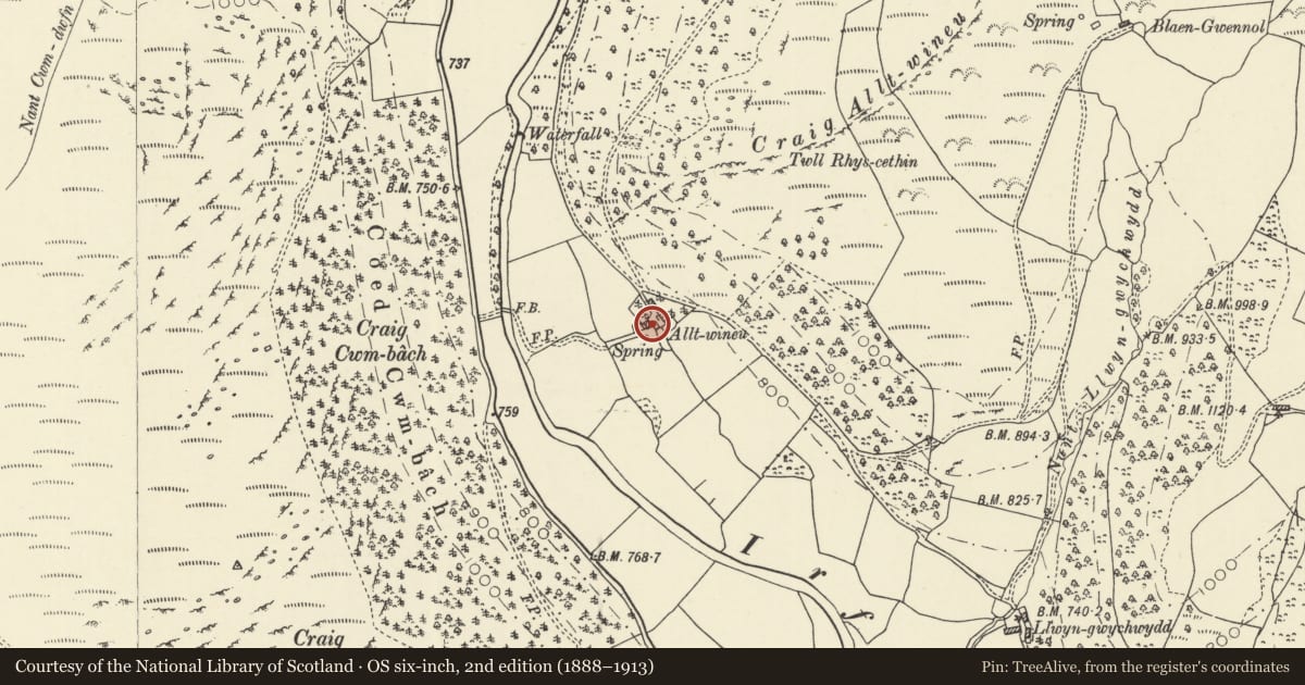
Slide toward Today to fade the historical sheet and see the modern map underneath.
David Rumsey Map Collection, Stanford LibrariesDavid Rumsey Map Collection, Stanford LibrariesDavid Rumsey Map Collection, Stanford LibrariesDavid Rumsey Map Collection, Stanford LibrariesDavid Rumsey Map Collection, Stanford Libraries
5 historical maps cover this location, the earliest the 1608 map "(13) Cambriae Typus." (David Rumsey Map Collection, Stanford Libraries).
Historical maps covering this location
- 1608 · (13) Cambriae Typus. (David Rumsey Map Collection, Stanford Libraries)
- 1637 · Particular description of Wales. Cambria seu Wallia (David Rumsey Map Collection, Stanford Libraries)
- 1830 · V.3:11-15:XV. Britisches Reich. A. Kon: England. b. Frstenthum Wales: Shire: 37-40 (David Rumsey Map Collection, Stanford Libraries)
- 1899 · 196 Builth (Hills) (David Rumsey Map Collection, Stanford Libraries)
- 1901 · Sheet 14. (David Rumsey Map Collection, Stanford Libraries)
Cadw's description
Location
Located at the N end of a long narrow lane which runs parallel and E of the River Irfon. Approx 1.3 km NW of the church of St David.
History
Shown on the Llanwrtyd tithe map of 1846, and probably of early C19 date.
Exterior
Two-storey 3-window house of whitened rubble stone under a slate roof with stone end stacks. Projecting boarded eaves; large quoins. All the openings are under shallow segmental heads of stone voussoirs. The entrance is offset slightly to L of centre and contains a half-glazed planked door under a multi-pane overlight. All the windows are hornless 8-over-8-pane sashes with stone sills. The N gable end has a late C20 casement window offset to the L to the lower storey. Late C20 half-glazed door to S gable end offset to R. The rear has 3 windows to the upper storey, as front. Similar window below to L. To the R is a late C20 casement window not aligned with those above.
Interior
No access to interior at time of inspection. The exterior would suggest a central staircase hall, with the largest reception room to the R.
Reason for designation
Listed as an early C19 farmhouse retaining its character and detail.
Nearby in the register
- Cwm Irfon Standing StoneStanding Stoneunder 1 mi
- DinasDomesticunder 1 mi
- Church of St DavidReligious, Ritual and Funeraryunder 1 mi
- Former Pumphouse at Victoria WellsNo class recorded1 mi
Other entries of the same register within about three miles of this one, by straight line.