Cof Cymru: National Historic Assets of Wales · Wales
Railway Bridge over River Irfon
Llanwrtyd Wells, Powys, Wales
A Grade II listed building in Llanwrtyd Wells, Builth Wells, Powys, designated on 19 January 2001.
The record
- Designation
- Listed building, Grade II
- Broad class
- Transport
- Date of designation
- 19 January 2001
- Locality
- Llanwrtyd Wells
- Town
- Builth Wells
- Community
- Llanwrtyd Wells
- Unitary authority
- Powys
- Country
- Wales
- Coordinates
- 52.10309, -3.63678
- Cadw reference
- 24528
Slide toward Today to fade the historical sheet and see the modern map underneath.
David Rumsey Map Collection, Stanford LibrariesDavid Rumsey Map Collection, Stanford LibrariesDavid Rumsey Map Collection, Stanford LibrariesDavid Rumsey Map Collection, Stanford LibrariesDavid Rumsey Map Collection, Stanford Libraries
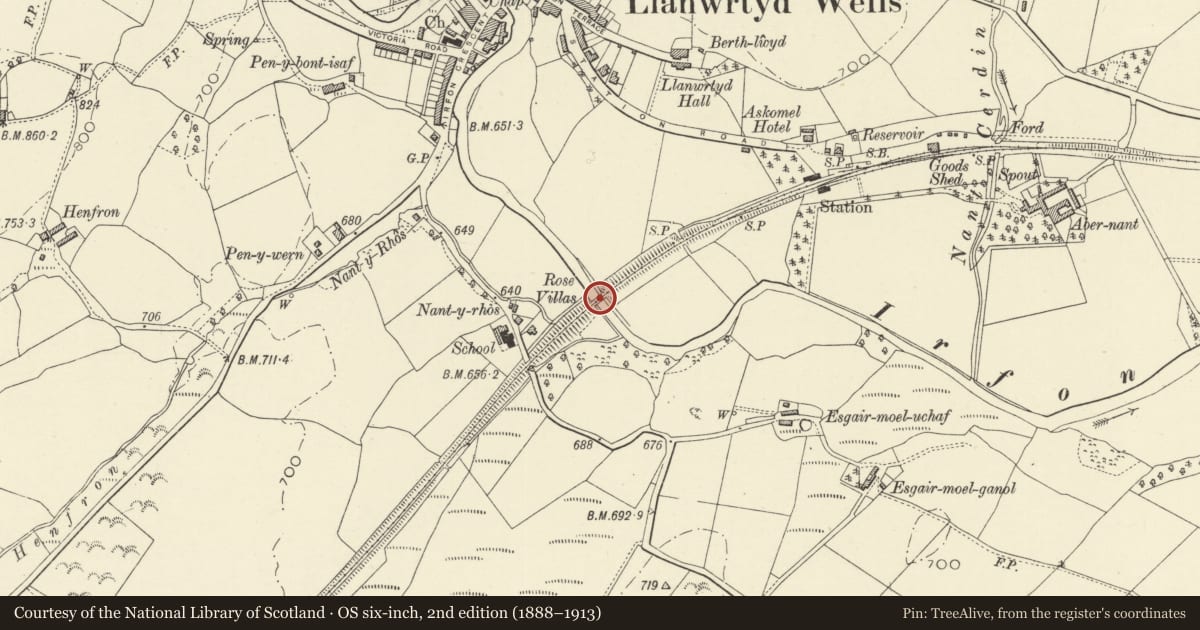
5 historical maps cover this location, the earliest the 1608 map "(13) Cambriae Typus." (David Rumsey Map Collection, Stanford Libraries).
Historical maps covering this location
- 1608 · (13) Cambriae Typus. (David Rumsey Map Collection, Stanford Libraries)
- 1637 · Particular description of Wales. Cambria seu Wallia (David Rumsey Map Collection, Stanford Libraries)
- 1830 · V.3:11-15:XV. Britisches Reich. A. Kon: England. b. Frstenthum Wales: Shire: 37-40 (David Rumsey Map Collection, Stanford Libraries)
- 1899 · 196 Builth (Hills) (David Rumsey Map Collection, Stanford Libraries)
- 1901 · Sheet 14. (David Rumsey Map Collection, Stanford Libraries)
Cadw's description
Location
Located at the SE corner of the Dolwen Fields and surrounded by trees. To the W of Llanwrtyd Wells Station.
History
The Central Wales Extension bill received royal assent in 1860. This section of the line, which runs from Llanwrtyd Wells into Carmarthenshire, was opened for public traffic on 8th October 1868. This bridge is one of the original structures on the Central Wales Extension railway and does not appear to have been altered.
Exterior
Single-span arched cast iron railway bridge. High segmental arch constructed from substantial jointed I-section beams with open lattice-work to the spandrels. The 2 faces are linked by round-section struts. Flat cantilevered deck; moulded cast iron deck plate supporting iron openwork parapets containing panels with diagonal cross-members. The abutments are of snecked rock-faced stone; the iron arches spring off ledges with dressed stone copings. Stone end piers to bridge with rock-faced capstones and blue brick to interior sides.
Reason for designation
Listed for its technical interest as a fine piece of engineering on the Central Wales Extension railway.
Nearby in the register
- Llanwrtyd Wells Station & North PlatformTransportunder 1 mi
- Llanwrtyd War Memorial InstituteCommemorativeunder 1 mi
- Pont Rhyd y FferauTransportunder 1 mi
- Capel Bethesda including attached vestries and forecourt wall and railingsReligious, Ritual and Funeraryunder 1 mi
Other entries of the same register within about three miles of this one, by straight line.